Release Notes - 30th January 2023
New Features
Point cloud to CAD comparison analytics
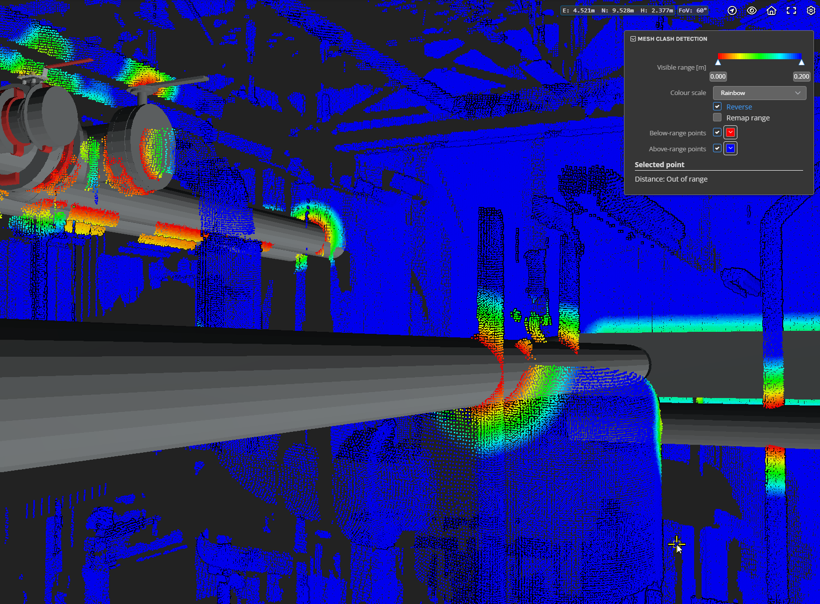
A first version of point cloud to CAD model distance/clash analytics has now been released. This provides a highly scalable way to calculate the distance of each point in the point cloud to a specified CAD model - for applications such as clash detection or conformance to plan. The current version performs a full 3D distance computation to determine the closest surface to each point based on surface topology and normals. Future releases will include more specific variants such as vertical-only distances for more specific applications.

Note: this feature is only available to customers with an Analytics subscription. Please contact Pointerra support for assistance with enabling and setting up this analytic in your account.
Advanced point cloud filters
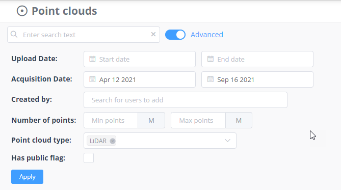
Searching on the company point cloud management page has been enhanced with more structured search options. These can be combined with the existing text search to allow search/filter based on dates, users, and other metadata. Use the advanced switch on the point cloud management page to show the new options.


Improvements/Changes
Pointerra3D Core
- If a collection has permissions that would allow another company to take ownership of point clouds (ie has been set up to allow moving between accounts), a warning is now shown when moving point clouds into that collection.
- 360 photos (plus metadata file) can now be uploaded and processed from a Zip file.
- 360 photo metadata files that have missing/blank heading, pitch, or roll values now default the value to 0. Previously blank values would result in a processing error.
- When performing an "edit and reprocess" on a 360 photo dataset, you can now replace the CSV file (even if the filename has the same name). This allows correcting/updating the metadata file for a 360 dataset without having to upload all of the images again.
- When exiting the 360 photo viewer, the last used exit option (return to previous 3D view or go to similar view to the 360 photo view) will be remembered and used as the default in the future.
- "Shared with me" list now has pagination to improve usability when there are a large number of point clouds in the list.
- Point clouds that are part of a merged point cloud can now be deleted, even if the merged point cloud is still active. Previously this would not be allowed.
- New audit tracking events added for moving point clouds between accounts.
- Photo set datasets now detect missing photos (ones that exist in the metadata but have no JPG/PNG image file). These will be hidden by default in the 3D viewer but can be toggled back on in the dataset options.
- Most dataset processing jobs now return more comprehensive error information on failures.
- Non-georeferenced point clouds now display the unit names in the metadata.
- Additional tooltips added to icons on point cloud tiles to explain their meaning.
- Share links being sent to a large number of email recipients (total number of characters in email address list > 255) now supported.
- The dataset upload form now has additional information about supported file types for each dataset.
- The menu to access point cloud details, such as metadata, file, datasets has been moved to the lower information bar - you no longer need to expand the bottom panel to find them.
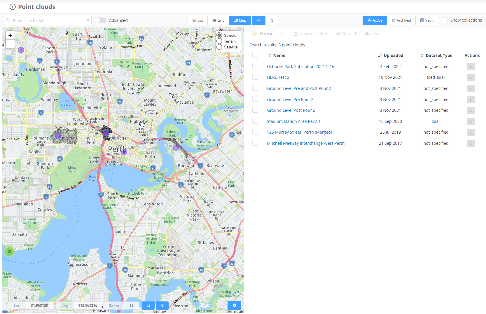
- The results for map searches are now viewed using a list control (instead of thumbnail tiles) and there is an option to display side-by-side or below the map.
Analytics
- There have been a number of improvements to handle multi-user editing edge cases where users are simultaneously saving data.
- Poles and wires analytics now supports detection and visualisation of companion/double poles where an existing power pole has been replaced and the original pole remains (but is generally cut off).
- Poles and wires dataset loading/viewing has been improved to handle much larger networks.
- Multi-user poles and wires editing now limits the maximum number of regions to 100. You will also be presented with the option to remove any regions (e.g. from a grid setup) that contain no poles.
- Poles and wires analytics can be seeded with a previous network model to assist with detection in cases of repeat capture of the same area.
- Additional tree analytics options are now available to improve detection and crown delineation for smaller trees (primarily for suburban areas).
- LAS override will now automatically switch to generating LAS1.4 if new classes with point types greater than 31 are added to the classifications.
Utility Explorer
- Heat map display of encroachments and 360 photo locations added to allow display of these layer types when zoomed out.
- Display of new encroachment types added.
Bug Fixes
- Model key point generation could fail if there were regions with no points
- If two users created a new classification edit on the same poles and wires dataset it could sometimes create multiple edit sessions. The correct behaviour is that they should both end up in the same edit session.
- Photo sets with a space in the filename could fail to generate pyramid data for viewing.
- 360 photos uploaded in a folder containing a comma would fail to process.


