Release Notes - 6th April 2023
New Features
Point cloud change detection
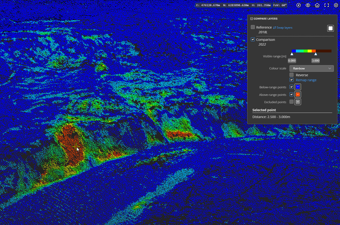
A new point cloud change detection/comparison analytic has now been released. This provides a highly scalable way to calculate the closest distance of each point in a point cloud to another point cloud. The current implementation requires you to create a merged point cloud and gives you the option to select 2 layers within the merged cloud to compare. The distance calculation finds the closest point in the comparison layer to each point in the reference layer using a local surface estimation (triangulation of points) in the comparison cloud. Results can be visualised in the 3D viewer (see image below) and polygons/contours can be exported. Future releases will include more specific distance calculation variants such as vertical-only distances for more specific applications.

Note: this feature is only available to customers with an Analytics subscription. Please contact Pointerra support for assistance with enabling and setting up this analytic in your account.
Large photo support
Photo sets are now automatically processed into a tiled multi-resolution format, providing a more dynamic viewing experience and the ability to deal with very large photos. The photo viewer now has interactive zooming as a replacement for the existing drag-box to zoom to an area of interest. Other functionality of the photo browser (and photo inspection) has been ported across to the new viewer.
Process multiple vector files into a single layered dataset
When uploading a set of vector files - for example multiple DXF files, you will now be presented with the option to process each file into a separate vector dataset (this is the existing behaviour), or to choose to unify all of the files into a single dataset and have each file displayed as a layer within the dataset. In some respects, this is similar to the existing grouping functionality that allows you to select and display multiple datasets as a group. The primary difference is that that the grouping is automatically created and the dataset is treated a single entity that can be added/removed/deleted. Downloading the files for a dataset will also download all of the layer files as a single archive - so this is a useful way to process vector layers that are meant to be viewed and used together. The names of each layer can be edited in the viewer and will be saved if you have edit permissions.

Improvements/Changes
Pointerra3D Core
- The company metrics tab now has an additional option to search and display recent actions performed by a selected user.
- Many database optimisations have been applied to speed up browsing point cloud collections and other aspects of the portal UI.
- When browsing collections, there is a new menu option available on either a collection or a point cloud, to show the permissions that a selected user has for that item. This function is only available to company administrators.
- The advanced point cloud search now has an option to search by sharing status (e.g. show all point clouds that are shared).
- "Show collections" switch moved to be next to the search/filter options.
- The point cloud sharing dialog now shows an option to create a simple "link to this view" URL that can be used to share with users in the same company.
- Users with edit permission on a point cloud can now edit the layer names in a merged point cloud. There is a new edit button that allows this when using the layers panel in the viewer.
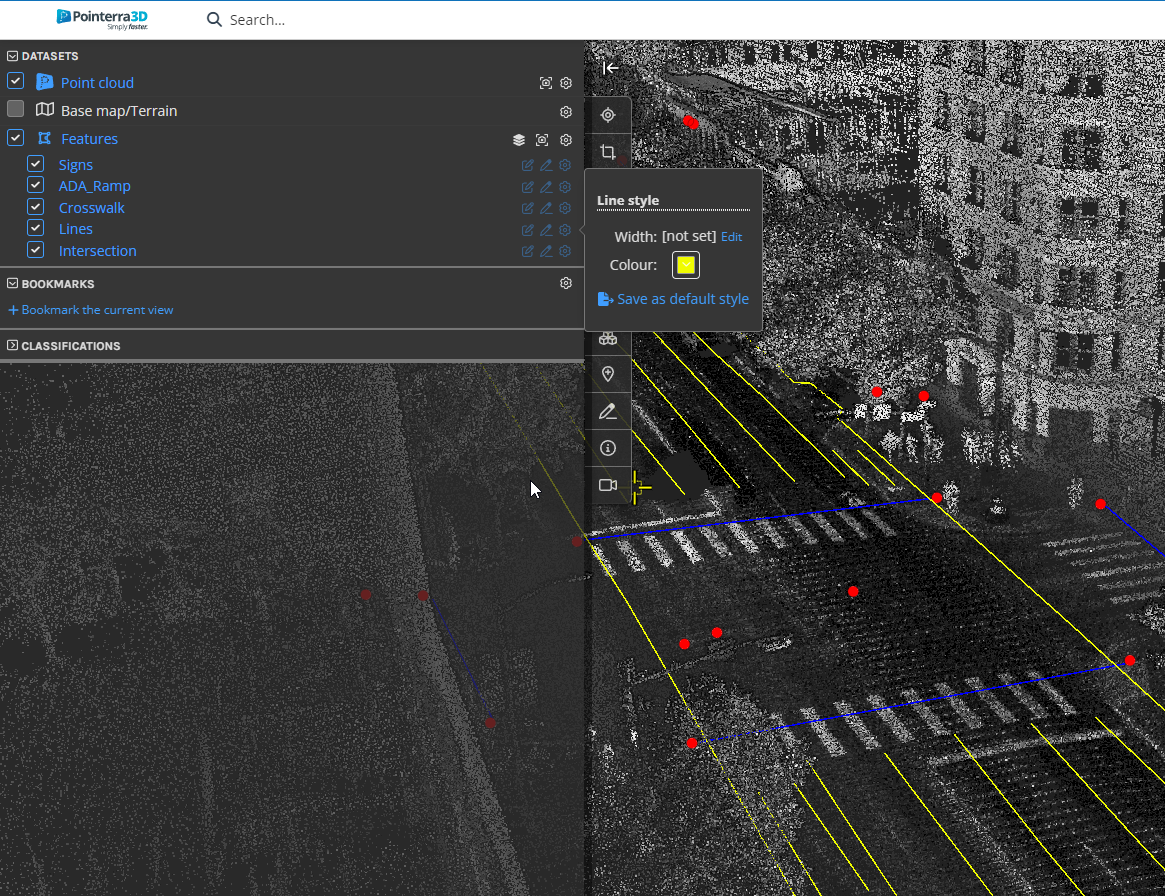
- Style options for vector dataset labels are now supported. This includes color, scale and the ability to set a maximum display distance for labels.
- Users with edit permissions can now edit and save vector dataset styles from within the viewer - a save button will appear once the style have been modified.
- There is now a delete all POIs button in the POI options panel. This will delete all POIs, or the list of POIs selected if a filter is active.
- Processing of orthoimagery now automatically determines the most appropriate max zoom level for display. In the past it was locked to level 24 (Web Mercator). It will now display at levels beyond 24 (higher resolution) if the image resolution requires it.
- Airborne Laser Scan (ALS) added to dataset types list.
- Numeric keypad keys now correctly map to the appropriate keyboard shortcuts (when Numlock is enabled).
- When viewing 360 photos, it is now possible to make interactive adjustments to the orientation corrections (e.g. invert pitch/roll values) using the new Orientation Metadata menu in the 360 photo viewer. This allows you to see the effect of adjustments in order to assist with getting the photos correctly aligned. Use the linked cursor when in split photo/point cloud mode to confirm the photos align with the point cloud.
- Adjustments to 360 photo metadata can be saved as the defaults for the dataset if the user has edit permissions.
- Scanview and 360 photos can now continuously update the view in the 3D viewer to match the photo view (when in 3D/photo side-by-side mode). Use the SHIFT key when clicking the link button or SHIFT+SPACE to enter auto-sync mode. To revert, either click the link or press SPACE without the SHIFT key.
- Job processing speed improved for very large point clouds.
Analytics
- Span attributes can now be assigned from a vector linestring dataset (using 2D distance between the vector and the span to match). There is an optional filter to only assign attributes to a particular circuit type.
- New poles and wires edit tool to manually create "legs" for transmission towers added.
Utility Explorer
- Clearance reports now correctly take into account the current scope (ie, the selected datasets).
Bug Fixes
- Fixed email for analytics download requests going to the original dataset creator instead of the download requestor.
- Fixed an error causing sensor pre-processing from S3 uploads with credentials to fail.
- Fixed file validation logic preventing some datasets with over 1000 files from being uploaded.
- Classification editing for point clouds with complex boundary polygons would sometimes update/save very slowly.
