Release Notes - 9th August 2023
New Features
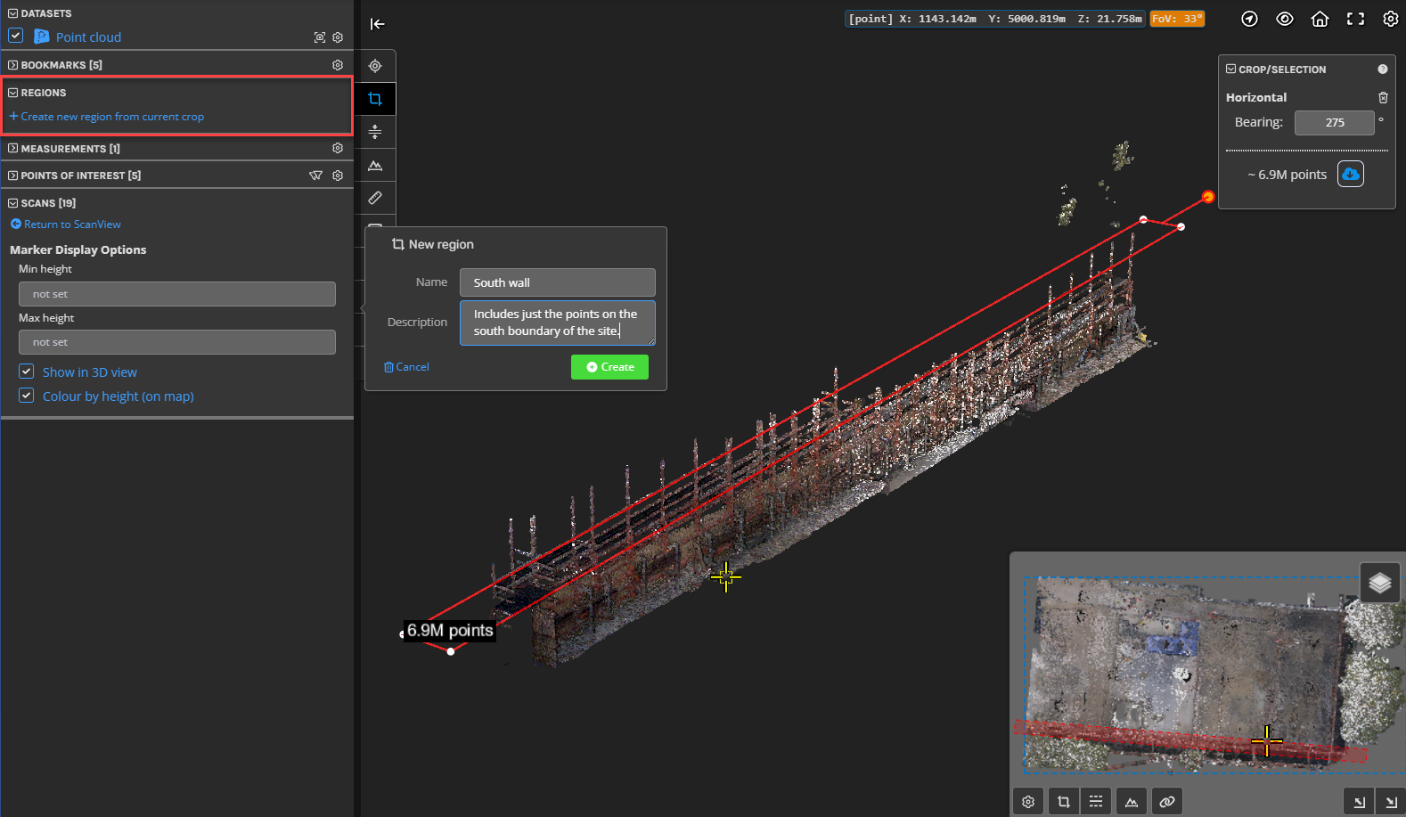
Point cloud regions
You can now give a name to a cropped set of points and save this as a region (for example, "First Floor"). The Regions panel will then list all regions that have been created, allowing you to quickly restore a cropped view of a point cloud (without applying any other settings as would happen with a bookmark). When a region is active, it will always be applied to the view, irrespective of any further cropping, cross-sections, etc that are applied. This means that you can effectively have multiple crops active. Exporting of points will take into account any region that is active.

Improvements/Changes
Pointerra3D Core
- Share links with download permissions now have the Downloads tab active and open when a user first views the link. This should make the file download functionality more obvious to new users.
- Added new company option to override user home page preference and force it to be the My Company page.
- Sections have been added to sort the links in the left navigation bar on the "My Company" page.
- A number of point cloud exporting enhancements:
- Added the ability to set the name/filename for exports.
- Added a button to export the current point cloud from the "Files" tab under the viewer. If no crop is currently active, then the export will default to the whole point cloud (a crop box extending to the bounds of the point cloud will be automatically created).
- You can now export point cloud data that has both a crop and a crop region active.
- You can now export from a plan section view.
- You can now export from the vertical/height clipping tool (without needing a horizontal crop)
- 3D model transforms can now be saved as a global default. This means that when the model is added to another project, its transform will be preserved.
- Added a label to polygons and polylines displaying properties such as length and area. The label can be toggled on/off for all objects in a drawing layer via the "Layer style" side panel.
- Improved the computation of the photo look direction when roll, pitch, yaw angles are uploaded in the CSV calibration file (EXIF photo inspection).
- Added support for rotating images in the photo viewer, as well as a button to save current rotation as default.
- When uploading images to a POI (e.g. from a phone), you now have the option to resample and upload at lower resolutions.
- Photos can now be set as hidden. Hidden photos will not show by default but can be seen by enabling "Show hidden photos" from the photo viewer option menu.
- An icon to toggle the use and distance for near clipping planes has been added to the top-level viewer icons.
- Scans can now be set as hidden. Hidden scans will not show by default but can be seen by enabling "Show hidden scans" from the scans panel or the options menu on the map in scanview.
Utility Explorer
- When selecting a pole, the 3d viewer now has an option to show 3D labels with details for all connection point (heights), service wires (length and bearing), and guy wires (length).
Bug Fixes
- Fixed some large Control Point Adjustment (Pre-processing) jobs becoming stuck during processing.
- Fixed ContextCapture datasets not generating the photo pyramids.
- Fixed issues caused by uploading EXIF photos that are not present in the calibration csv.
- Fixed issue where sometime analytics report emails could contain URLs that point to an older version of the output files.
- Fixed a bug causing some datasets to appear locked in the viewer, when other datasets in the project are published to a linked app.
- Fixed a bug that prevented the user from panning the camera when the cursor was over an object while the drawing tool was active.
