Release Notes - 3rd October 2023
New Features
Secure Share Links
You can now create share links that are locked to a specified email address.
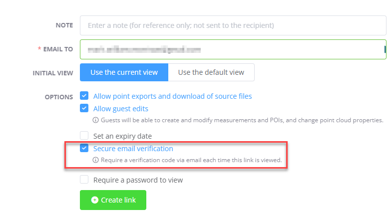
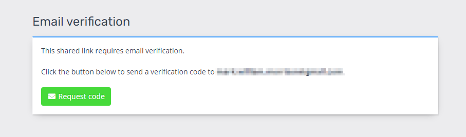
In this mode, before being able to access the share link, the user will be required to enter a code. To get the code, the user must click the Request Code button - which will send the code to the email address that is linked with the share token (the user cannot change this address). The user will then progress to a code entry screen, where they will enter the received code.
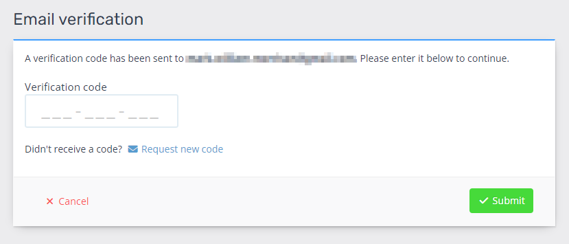
If the user is able to receive the mail, then they will have the code and will be able to enter it to proceed.
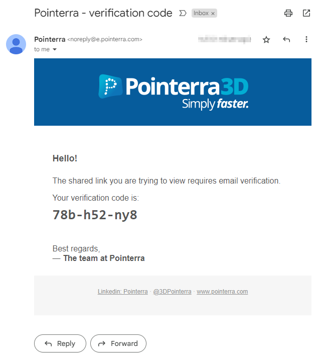
The code expires after 5 minutes, and every time the share link is accessed the previous codes are invalidated. Whoever is viewing the share link must have access to the email address that it is linked with - therefore providing a degree of protection against unauthorized share link usage and an audit trail of who received the unlock code.
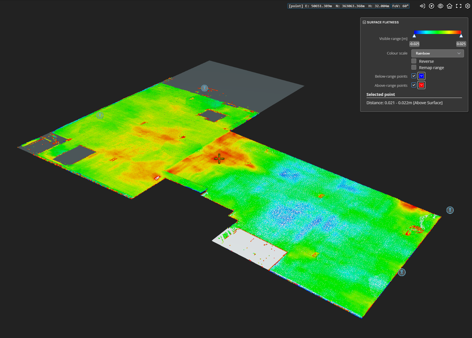
Floor Flatness Analytic
The Floor Flatness analytic generates a heatmap that visualizes the conformance of the point cloud to a design surface or level. Points are colored in a gradient from red to green to blue. Red points lie above the surface, green points lie on, or close to, the surface, and blue points lie below the surface.
You can define the reference surface for comparison through either of the following methods:
1. Upload a 3d model and select it for the analytic.
2. For cases where the surface is horizontal, such as a floor, you can use a bounding polygon to delineate the extent of the test area, along with entering a design height to check against.
Note that this functionality is only available to customers with an Analytics subscription.
Improvements/Changes
Pointerra3D Core
- The screen space ambient occlusion setting now persists across sessions (remembered by the browser).
- The option to hide scans has now moved into main scanview visibility menu. A hidden tag shows on scans that are hidden. Updated the markers used to show scan station locations in the 3D view.
- Fixed empty photo groups causing ContextCapture and Metashape photo dataset processing to fail.
- Photo datasets now support importing multiple photo groups for ContextCapture, Metashape and EXIF inspection formats.
- Implemented more parallel steps and other optimisations in the processing of 360 panoramic photo jobs. This results in massive speed up for large 360 jobs.
- Added column to share links table to show the date the share link was created.
- Prevent browser password managers from overwriting existing credentials when creating share links with a password.
- When you submit a support request, you will now receive an email containing the requests' details and a tracking number that will allow you to follow up or add more detail via email.
- Ensure POI coordinates for geographic coordinate systems are shown and exported using degrees instead of radians.
- POI labels no longer depth test against other objects/terrain by default. There is a new setting in the POI options to enable depth testing when required.
- Clicking a POI from the POI list will now show the properties dialog if the POI has properties to show (images, link, or notes).
- Improved processing times for DXF imports.
- Added the ability to delete processed data from pre-processing jobs.
Analytics
- Clicking on the minimum clearance point indicator for a span will toggle the label visibility from hover to always visible.
- Increased the size of the minimum clearance point indicators
- Clicking on a clearance sample dropper will toggle the label visibility from hover to always visible.
- Prevent the creation of overlapping regions when initialising the multi-user editing regions for poles and wires.
- Added a time-based check to determine if there is a newer version of a dataset available (someone is editing at the same time someone is viewing). If there is and warning is displayed with options for resolving.
- Tweaked task concurrency to make better use of virtual cores, resulting in processing speed improvements.
Utility Explorer
- Added a toolbar button to the map view to allow user to drag a box to specify the area of interest to view the point cloud in the 3D viewer.
- Added an "Assign pole distance attribute" tool that will assign an increasing pole ID based on the distance the pole is away from a specified vector point feature.
- Added support for GeoJSON and ESRI Geodatabase formats to pole exports.
- Orphaned poles (poles deleted in new versions of an existing dataset) are now hidden by default. There is a checkbox under the pole filtering options to show orphaned poles.
- Added UI popups to show report generation in-progress status and notifications.
- Fixed a bug occasionally causing publishes to external apps to fail.
- Importing pole report files can now auto-assign the pole inspection status from information in the filename (using a regex to extract the status code.)
- Network data can now be exported in GeoJSON, ESRI Geodatabase, and KML formats
Bug Fixes
- Fixed a bug causing pre-processing uploads with a capital ZIP extension to fail.
- Fixed issue where importing POI CSV files into a project using lat/lon spatial referencing fails.
- Fixed some JPEG images not being imported correctly with photo sets.
- Fixed inactive "Compare Layers" analytics in a project causing issues with bookmarks and default viewer settings.
- Fixed an issue where clicking away from the dataset delete dialog was accepting rather than cancelling the delete.
- Fixed "New Collection" button not working on the point cloud upload page.