Release Notes - 29th November 2023
New Features
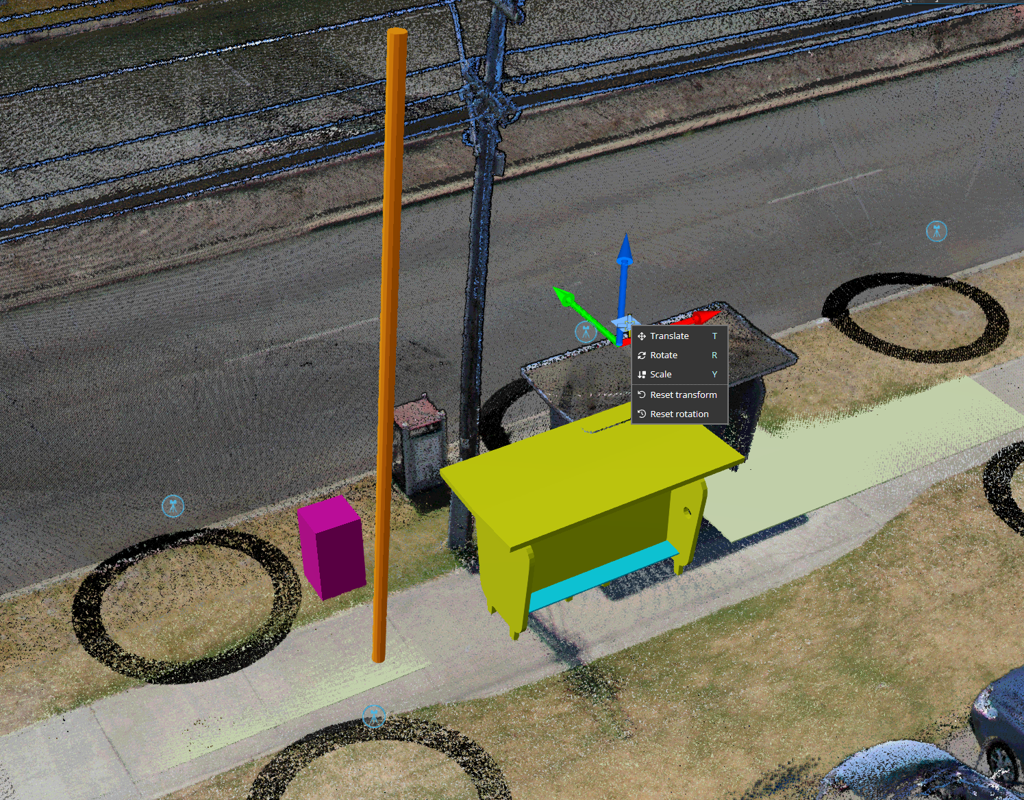
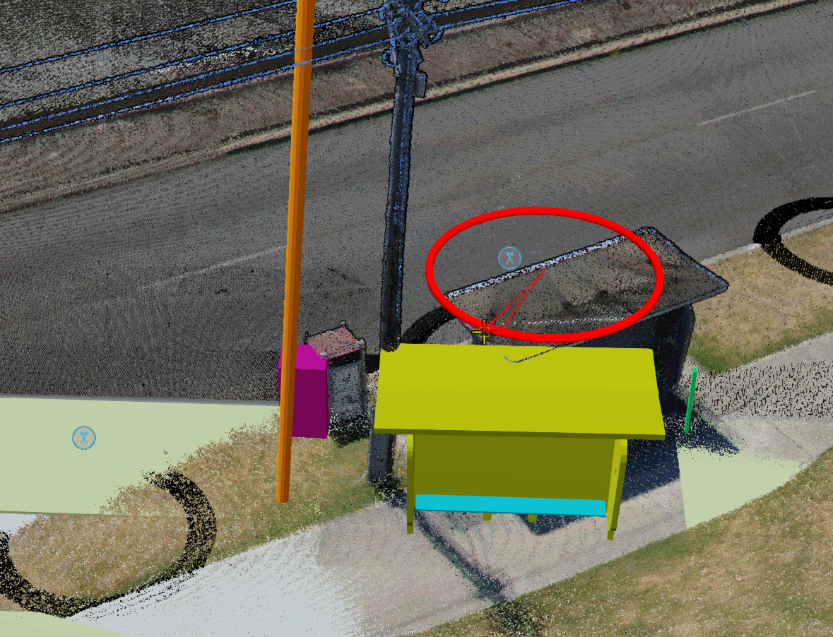
3D model manipulator
It is now possible to transform (translate, rotate, scale) 3D models interactively. This is an alternative to using the existing tie-points transformation. In the same manner as tie-point transformation, the updated model orientation can be saved as the default for the dataset, or saved temporarily via a bookmark. Any analytics that are run on the transformed model (e.g. clash detection against a point cloud) will be aware of the new orientation.
To use the manipulator, select Transform Model from the 3d model's dataset properties. Then use the manipulator that appears in the scene to adjust the model. The right-mouse context menu allows you to toggle the manipulator between translate/rotate/scale modes.


Improvements/Changes
Pointerra3D Core
- Improved accuracy of reported point counts when the point cloud is cropped.
- Enabled scrolling of the multi-vector upload dialog when the number of files in the list is large.
- Added support for showing the dataset description for 3D models in the info tool properties (you can use html syntax in the description to format)
- Improved support for DXF reading of entities inside DXF collection entities.
- Auto-remove Paper Space features when creating 3D vector layers from DXF files.
- Removed height datum options when exporting drawing as dxf/geojson/kml, as the correct height datum is always specific to the file-format.
- Improved reporting of point cloud build errors.
- Increase the maximum number of point clouds that can be deleted as a batch when selecting multiple point clouds (was limited to 5).
- TIF files now validate that the format is 32 bit float when processing as a point cloud.
- Fixed behaviour of the browser "back" button when navigating through point cloud collections.
- Added "From Below" option to view context menu.
- Added a manipulator tool for 3d models allowing for interactive translations, rotations and scaling.
- When exporting a DEM and selecting "reimport as pointcloud", any terrain or contours that are also created will be imported into the new pointcloud.
- Improved the DEM and contour creation workflow. When creating a DEM export, the user is now presented checkboxes, depending on which export file types are selected:
- Publish a pointcloud from exported files
- Re-import as a terrain dataset
- Re-import contours as a vector dataset
- In addition, the files in the downloadable .zip file are now placed in subdirectories according to file type to make it easier to locate specific files, e.g. hillshade/, pointcloud/, contours/, etc
Analytics
- Added new noise filtering analytic (currently in beta testing - contact sales/support to get early access).
- Added a minimum wire length option to the "Add unattached wire" tool when there is one pole selected.
- Adjust rock bolt display graphics to support bolts on an angle.
- Analytics that use 3D models now respect any transform that was applied to the model when the analytics was run.
Utility Explorer
- Added a tool to create an area of interest polygon that spatially filters poles, spans and encroachment points. The current AOI selection applies to all functionality, including display, filters and exports.
- All reports and exports now have the option to respect applied filters.
- Added ability to create a filter from a calculated attribute (sum, difference, etc of 2 other attributes).
- Added report attributes configuration to specify default included/excluded attributes when creating reports for poles, spans and network data.
- Improved layout of pole reports to allow for longer file names.
- Add automatic expiry and deletion of old dataset versions.
- Added support for automatically finding the closest 360 panorama or Cyclomedia spherical image for a selected pole. Simultaneously view 3D point cloud and Spherical images side-by-side.
- Minor update to the UI/layout to remove unnecessary space and generally tidy up the interface.
Bug Fixes
- Fixed a bug where custom terrain data was not being used for the terrain.
- Fix for terrain imports with geoid heights being displayed offset from the base terrain or point cloud.
- Fixed an issue with external dataset editing not showing the edit dialog.
- Fixed an issue where importing a vector file could fail when a user-supplied spatial reference was not overriding the (incorrect srs) in the file.
- Tiled exports with a white space character in the name filed to export.
- Fixed incorrect elevation for contour and terrain reimports where vertical units were not meters.
