Release Notes - 18th January 2024
New Features
User Messages
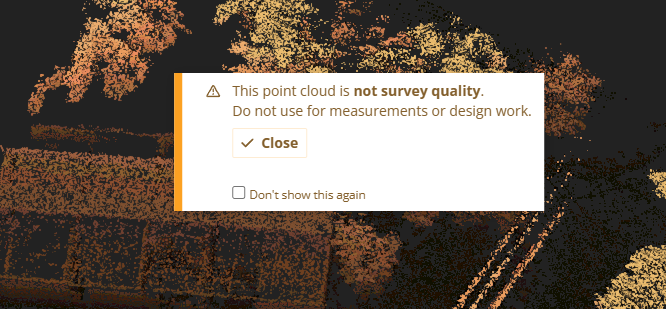
There is a new field on the point cloud metadata that allows you to add a message to present to users whenever the project is opened in the viewer. This could be used to show a warning about data quality to users, or for any other purpose. You can allow the user to hide the message after viewing it once or force it to display every time. Company admins may also create a list of predefined user messages to select from (from the configuration tab).

Improvements/Changes
Pointerra3D Core
- When choosing to reimport exported points as a new pointcloud, the user is now presented with an option to select which collection to import the new pointcloud into. By default, it will use the collection of the original pointcloud.
- Added EXIF photo inspection support for DJI Zenmuse P1 and H20T cameras (without need to do a full photogrammetry solve).
- Added option to define the spatial reference of photo metadata when uploading a photo set with a calibration file.
- Recap reader updated to use the latest Autodesk Recap library.
- Added DEM export UI option to specify 'No data' value.
- The visibility of individual drawing layers is now saved to defaults and bookmarks instead of just the visibility state of all drawing layers.
- Show additional context menu options in a submenu when a 3D model is selected.
- Datasets now have their description displayed in the dataset list view. It will also appear in a tooltip when hovering over their layer in the point cloud viewer.
- Added "view point from" and "fixed camera" context menu options in section tool.
Analytics
- Fixed an issue where point cloud differencing analytics could take a long time to run if point clouds do not overlap very much.
- Improved attribute schema editor to allow customisation of pole labels.
- Add delete wire tool into v3 poles and wires edit tools
- Add pole lean value into displayed data for the info tool.
- Added tool for assigning span attributes from a vector dataset (via spatial matching)
Bug Fixes
- Fixed DEM exports using the point cloud name instead of the user-specified name.
- Fixed an issue where re-processing a point cloud was disabled when the first page of files had been removed.
- The status of jobs linked to archived/deleted point clouds is now correctly updated to match the point cloud status when it is changed.
- Fixed zipped Recap uploads failing when the file names include special characters.
- Fixed issues relating to mouse picking on transparent 3D models resulting in spurious pan/zoom behaviours.
- Fix for projects that have very large number of photos sometimes crashing the browser on load.
- Fixed drawing layer DXF export for point clouds using geographic (lat/lon) coordinate systems
