Release Notes - 26th September 2024
New Features
Scanview photo mode
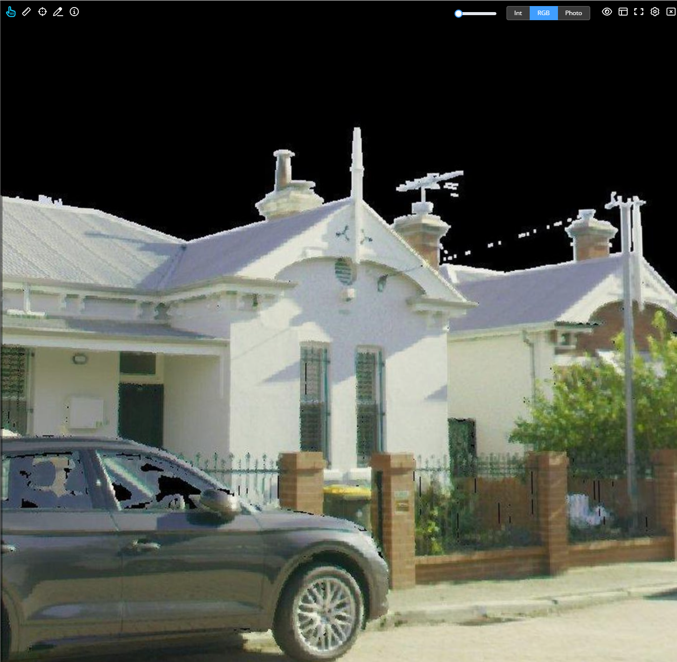
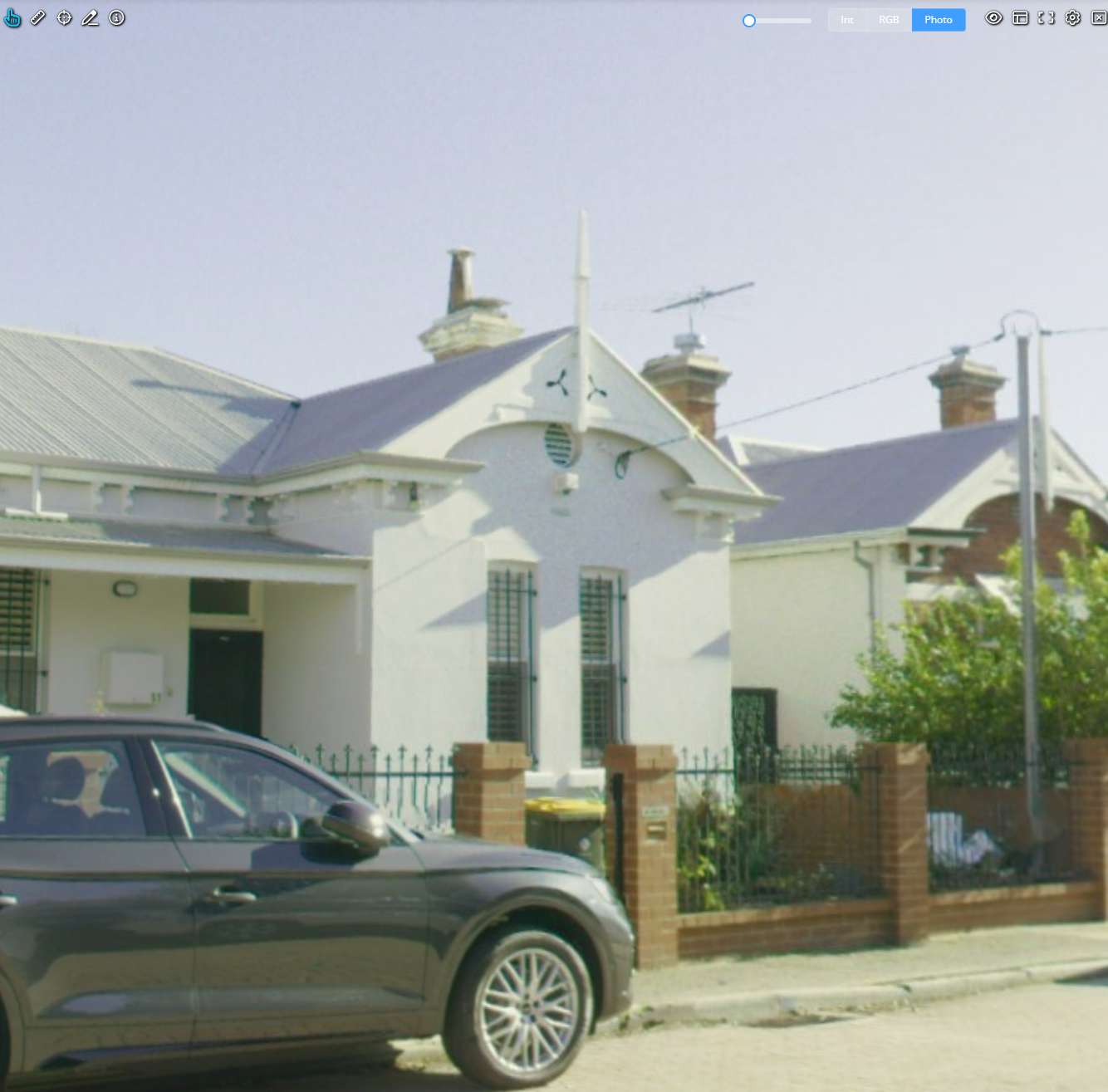
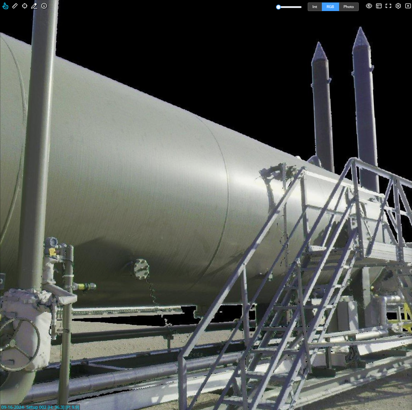
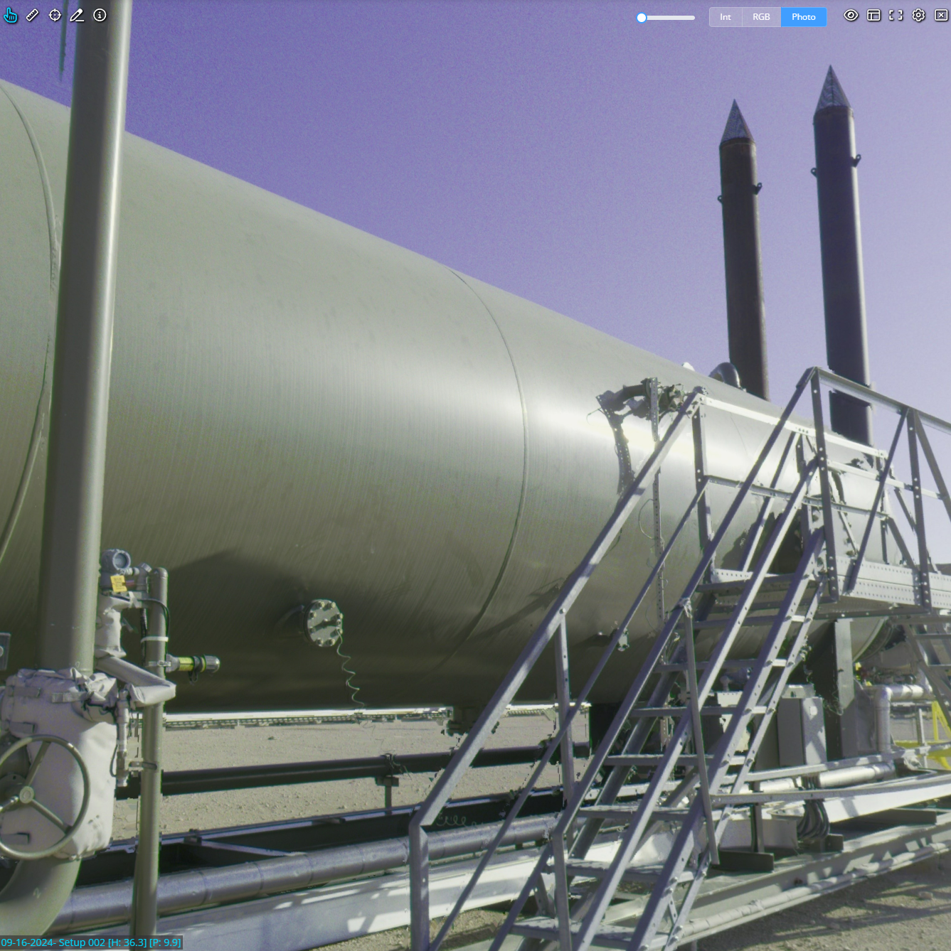
If a structured E57 or Recap project contains scanner photographs (either spherical or cube maps) these are now imported and become available as a "Photo" option in scanview. The RGB mode (recreated from coloured points) is still available even when there are photos, as the black pixels in RGB mode can be useful to indicate where there are no laser returns. RGB mode renders at the resolution of the scan, whereas the photo mode renders at the full resolution of the imagery (the resolution that was saved into the RCP or E57). All functionality (e.g. coordinate picking, measuring, POI creation, drawing) is available on the Photo mode in the same manner as the existing RGB and Intensity modes.
Note: this functionality is dependent on the photo data being exported into the E57 or Recap project in a standard manner. Please contact support if you believe your uploaded files contain scan photos and they are not being ingested, and we will work with you to create a workflow (if possible).
Existing projects will not have the new photo mode - they will need to be reprocessed (and have the photos embedded in the E57 or RCP files).

| RGB Mode (from points) | Photo Mode (from original scanner photos) |
 |  |
 |  |
Improvements/Changes
Pointerra3D Core
- Added support for direct reading of NavVis Panorama Image Poses CSV file when included in a 360 image dataset.
- Enabled the drawing tool to be used on scanviews for all customers.
- Support added for uploading .gpx or DJI .srt files with video datasets to provide GPS track data.
- Changed file selection on the map to display all files containing the selected point instead of just one.
- Greatly improved the loading speed and responsiveness of the photo viewer's grid/list view for large datasets.
- Added option to disable auto updating the inspection photos upon moving.
- Added option to limit the number of inspection photos shown.
- Added context menu option to POIs that have a link to open the link. Also added middle mouse button click to perform the same action.
- Added the option to include the project name and note in the email when creating a new shared link.
- Added new columns to the company csv report: file types, collections, last accessed date and recent view count.
- Added a new custom pre-processing mode to colorize a point cloud using an existing RGB imagery dataset.
- Added a new custom pre-processing step that allows you to split up a point cloud into tiles defined by polygons in a shapefile or GeoJSON file.
- When publishing projects to an external application (e.g. Utility Explorer) the publish status and information is now available in the published dataset list.
- If there are any truncated/unreadable point cloud files, the names of the files now get reported back in job processing failure notifications.
- Added additional form validation for pre-processing uploads and sensor creation.
Analytics
- Wires now display sag and clearance values (if present) in the info tool.
- Editing of basic properties of analytics datasets can now be done from the dataset manager.
Utility Explorer
- Add support for multiple data selection filters
- New cascader UI component for selection filters
- New pole profile view on the side bar for selected pole.
- Added a download button for photos when displayed in the photo viewer.
- You can see if there are any linked photos available in other datasets (e.g. epochs) when viewing photos of a pole. If there are other photos, you can switch to viewing them (in read-only mode).
- In the survey findings display list, you can now customise how the pole label is displayed (ie choose which attribute to use as the display name).
Bug Fixes
- Fixed inspection photos no longer being sorted by relevance.
- Fixed bounds of EXIF photosets being calculated incorrectly sometimes
- Fixed an issue where in-viewer 360 photo pose adjustments were not reverting correctly when undone.
- Fixed an issue causing some datasets to be reuploaded when a job is reprocessed.
