Release Notes - 5th March 2025
New Features
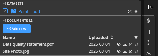
Project documents and links
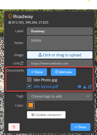
We've introduced a new Project Documents panel in the 3D viewer, making it easier to manage and view documents - removing the need to create a document dataset to add them into the project (this is now done for you under the hood). Supported file types, such as PDFs, can now be opened in a popout window directly inside the viewer. You can also add and remove files from existing document sets, as well as include links to external resources (URLs) that will appear in the file list. Additionally, project documents and links can now be associated with POIs, 3D model objects, and vectors, ensuring that relevant information is always accessible within the context of your data.
Coordinate Reference System Favorites
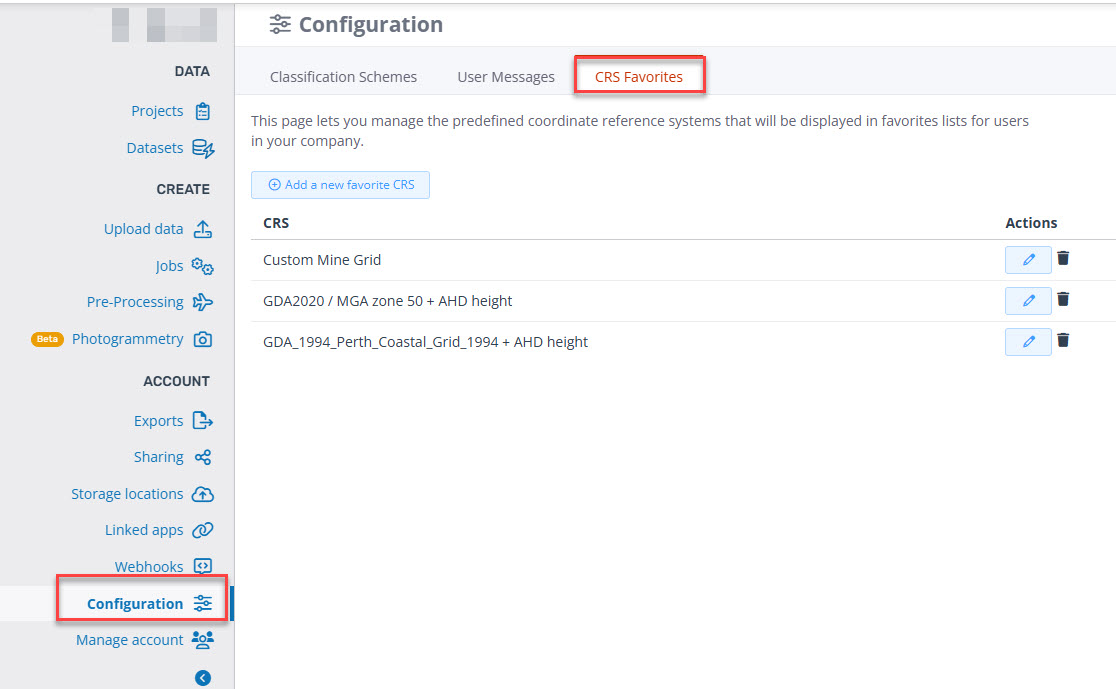
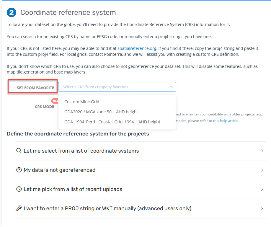
Admin users that have access to the company configuration page can now manage a list of predefined coordinate system "favorites". When users need to select a CRS, they will then be presented with the option to auto-fill from the list of company favorites. This will be particularly useful for creating predefined definitions for custom coordinate systems, WKT strings, or coordinate systems that are repeatedly used by your company.
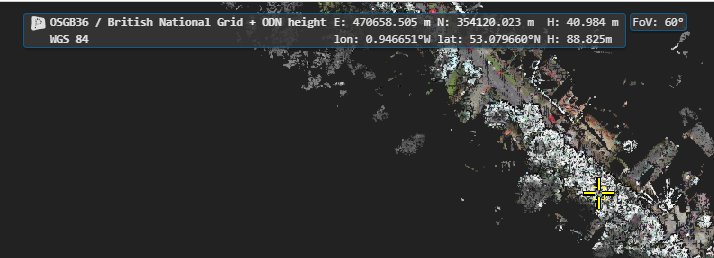
Multiple SRS display
Projects can now display coordinates from multiple coordinate systems in the 3D viewer. To enable this, the additional Spatial Reference System (SRS) must be selected from the company’s favorites list. Note: Users can only choose SRS options that have already been added to this list, and you can only use this feature for projects that use the Advanced Datum Mode (since datum shifts may be required - if you don't currently have Advanced Datum Mode enabled for your account, please contact support). To set up a secondary display coordinate, go to the Metadata tab, click the Add button, and select the desired SRS from the available options.
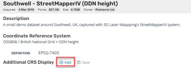
The viewer will then display the additional coordinates in the coordinate display panel.
Improvements/Changes
Pointerra3D Core
General
- Apply default OBJ model material colour when MTL file or material definition is missing.
- Set acquisition date automatically for photo sets using the latest time from photo exif data.
Portal UI
- Added a point count and maximum point limit to exports from polygons.
Viewer
- Made some refinements to the tile loading strategy for very large vector tiles
- Scanview UI now remembers split width.
- Added point cloud additional CRS options to export page, coordinate search and point info tool.
- The info tool has been improved to better handle multiple selections. Instead of displaying all selected datasets and features in a long list, they are now organized with a chooser, making it more intuitive to navigate and review multiple items at once.
Bug Fixes
- Fixed photosets with invalid altitude EXIF data not importing
- Fix for failing vector jobs that where SRS was using ESRI codes.
- Fixed long collection names overflowing to the right on upload page.
- Optimised tile loading strategy for some edge cases with new vector streaming.