Accessing and downloading the point cloud source data files
If your account has permission to download data from a point cloud, then you can access information about the raw source files by selecting the 'Files' tab below the viewer.
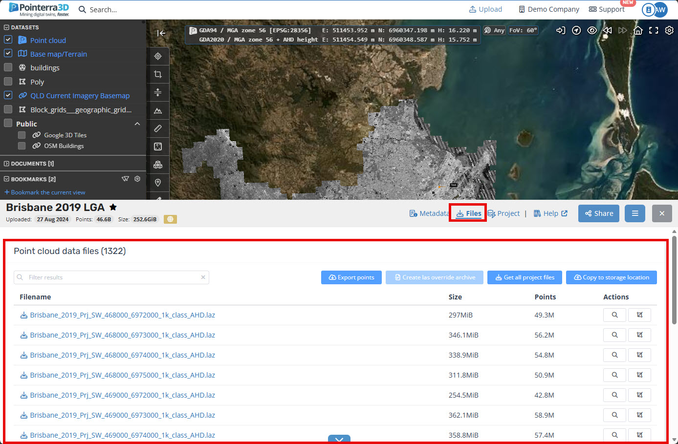
From this view, you can get summary information, such as the number of points in each file, and the file size. Click on the Filename link to download the file to your computer. The Actions buttons also let you quickly view and/or crop the view to the extents of each raw file. You can also enter text in the Filter box to limit the display to files that match the filter (i.e. contain the text that you have entered).
If you want to download all of the raw files, use the Get all project files button - this will create a single zip archive containing all of the files. The archiving process is completed offline and you will receive an email when the archive is ready for download. Keep in mind that for a large point cloud, the creation of the archive and the download could take a very long time.
Accessing Files from the overview map window
You can also turn on the Files layer in the overview map to see bounding boxes for each file. This is particularly relevant for tiled lidar datasets, that may have been created from a number of small files.
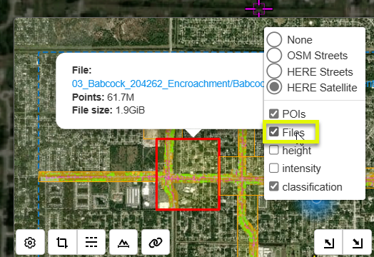
You can then click on a tile (the orange box) to get information and a download link for that particular file.
Note: for datasets that have a large number of files, the map will dynamically update the bounding boxes as the map is moved to make sure that there are not too many tiles being drawn.