Adding/Uploading a Spatial Dataset to a Point Cloud Project
Select the Point Cloud that you wish to add the dataset to.
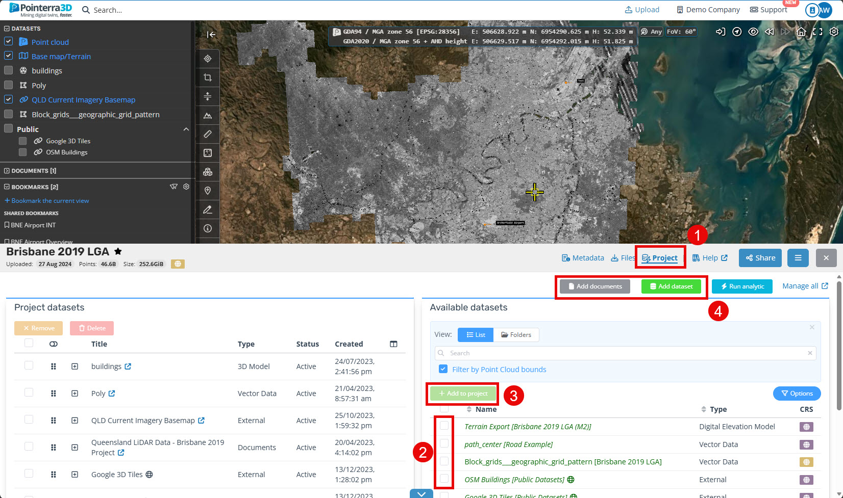
At the bottom of the viewer, select the "Projects" tab (1).
-
If the Dataset you wish to add has already been upload, select it from the "Available datasets" list (2) and click "Add to project" (3).
Note: by default the "Filter by Point Cloud bounds" is turned on and you may not see the dataset. Turn this off and use the search function.
-
If you want to create a new Dataset click "Create new dataset" (4).
-
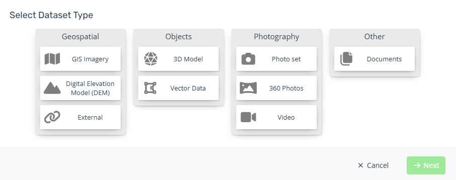
Select the Dataset Type (e.g. Vector Data) from the GUI and choose "Next".
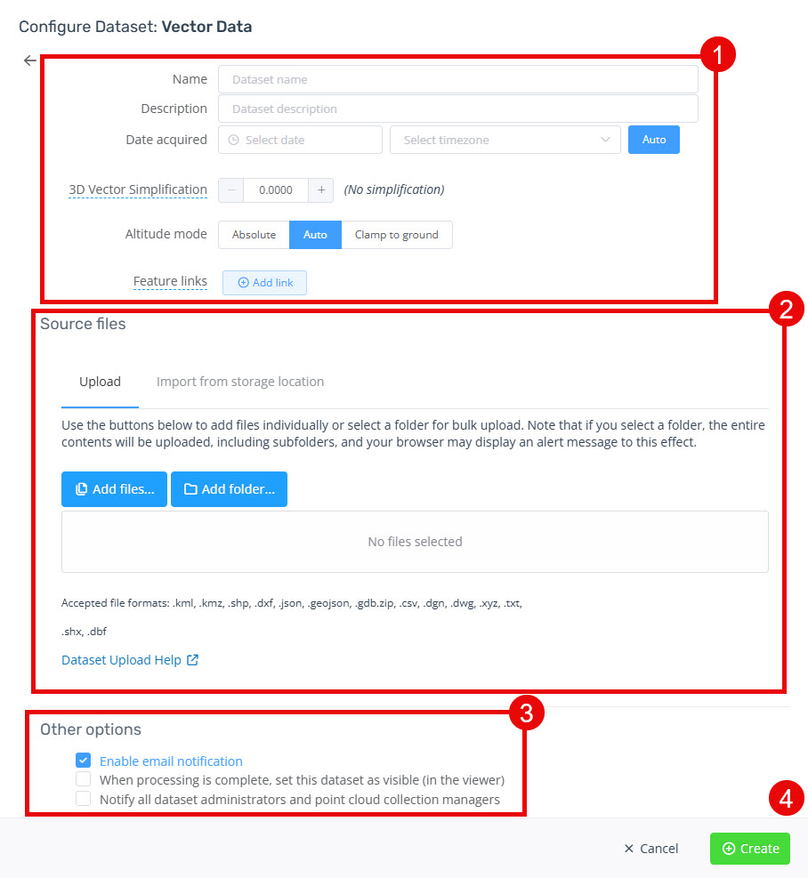
Input the properties for the dataset (1).
Select the source file/s you wish to upload directly from local storage or you can also import them through a URL by selecting the other tab (2).
Complete the other options provided for the dataset, such as the visibility of the point cloud to others (3).
-
Click "Create" to start the upload and import of the dataset (4).
Once the dataset has been imported, you will receive an email letting you know it is complete and ready to be viewed.