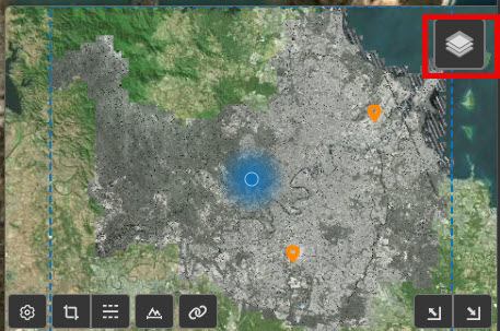
Showing Files on the Map
For point cloud projects that have multiple source files (e.g. tiled lidar data), it may be useful to view the extents of the raw source files on the map. To show file extents on the map, navigate to the Overview map and hover over the "stack" icon in the upper right.
This will open a menu where you can check the files option to display the boundaries of individual files that make up the point cloud on the overview map.
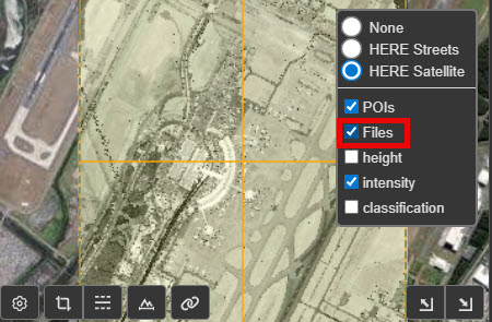
From here you can click on an orange box to display information about a file and get a direct download link for that file.