How do I add an external GIS service (WMS, ArcGIS, Nearmap)?
Pointerra also supports displaying GIS datasets that are hosted on an external service. This is currently possible for WMS, TMS, ArcGIS Mapserver and Cesium 3D Tilesets. Currently only API key style authentication, that can be included in the URL, is supported.
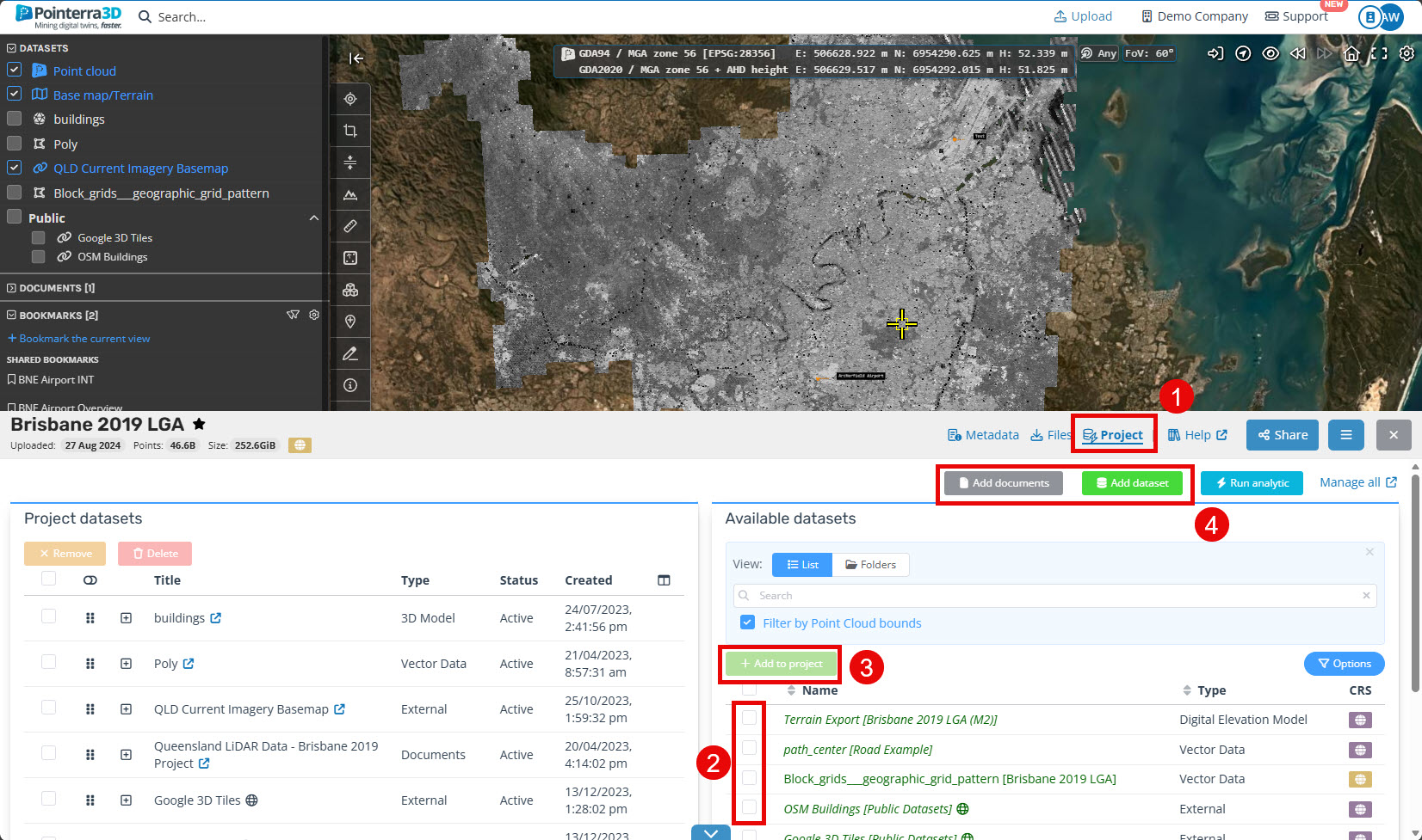
Select the Point Cloud that you wish to add the dataset to.
Scroll to the bottom of the page and select Project (1).
If the Dataset you wish to add has already been upload, select it from the Available datasets list (2) and click Add to project (3).
If you want to create a new Dataset click Add dataset (4).
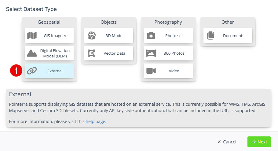
Select the External Dataset Type (1) and click Next.
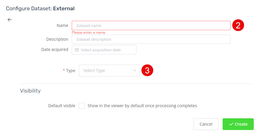
Give your dataset a name (2).
-
Choose the type of External Service you are adding (3). See each page for full details on how to add.
Arcgis Mapserver (WIP)
3D Tile Set (WIP)
TMS (WIP)
WMS (WIP)
-
Click Create to complete the process.
The new dataset layer should now be visible after you refresh the page.