How to run Haul Roads analytics
Note: The Haul Roads tools are not enabled by default for all customers. Please lodge a support request if the below options are not available and you would like trial access.
Overview
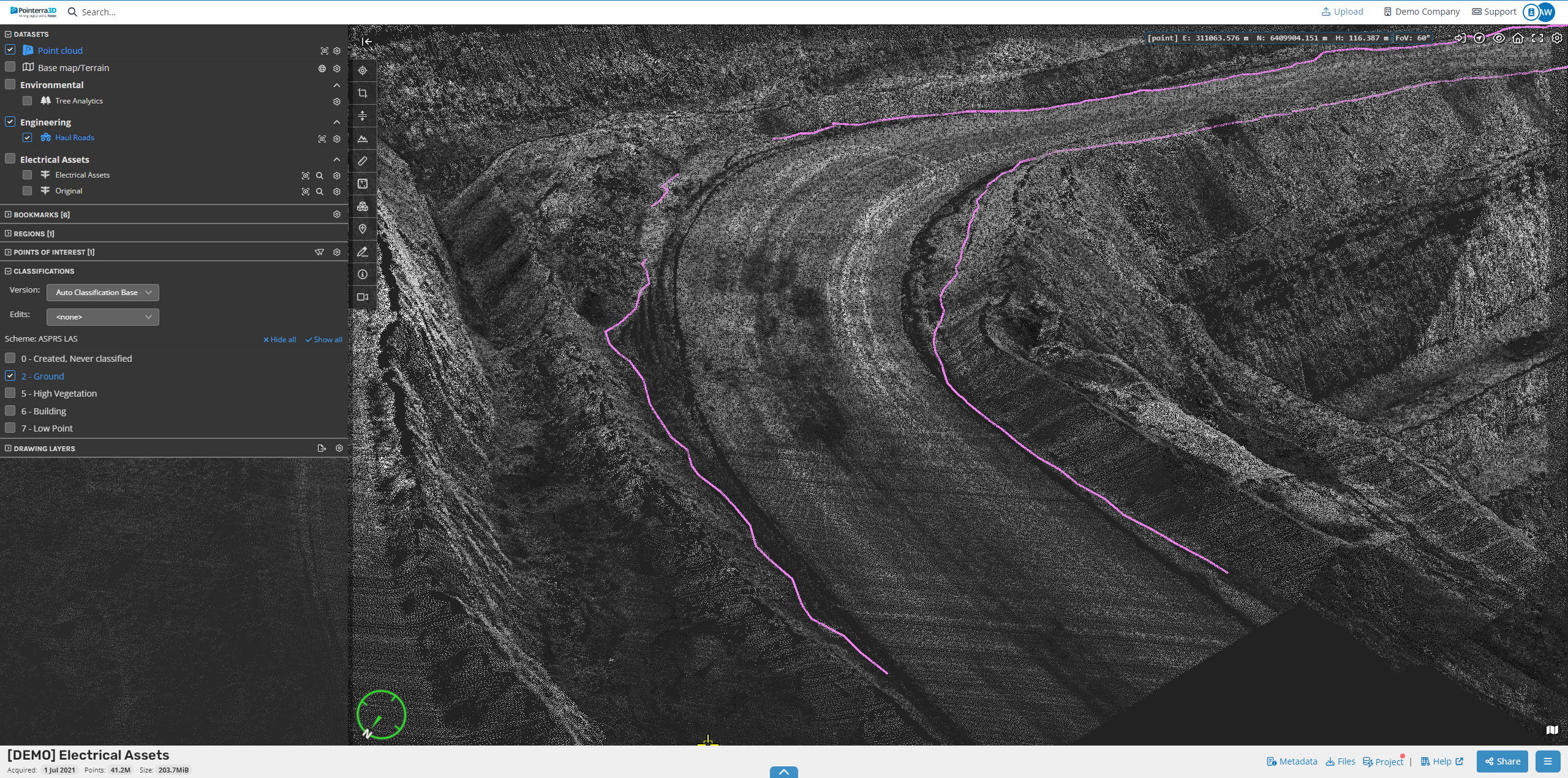
The Haul Roads analytics can be used to extract Haul Road data from an unclassified point cloud and then compare the extracted metrics to standards to report on compliance.
The extracted metrics include:
Road Edges locations
Road Grades - categorizes them based on severity
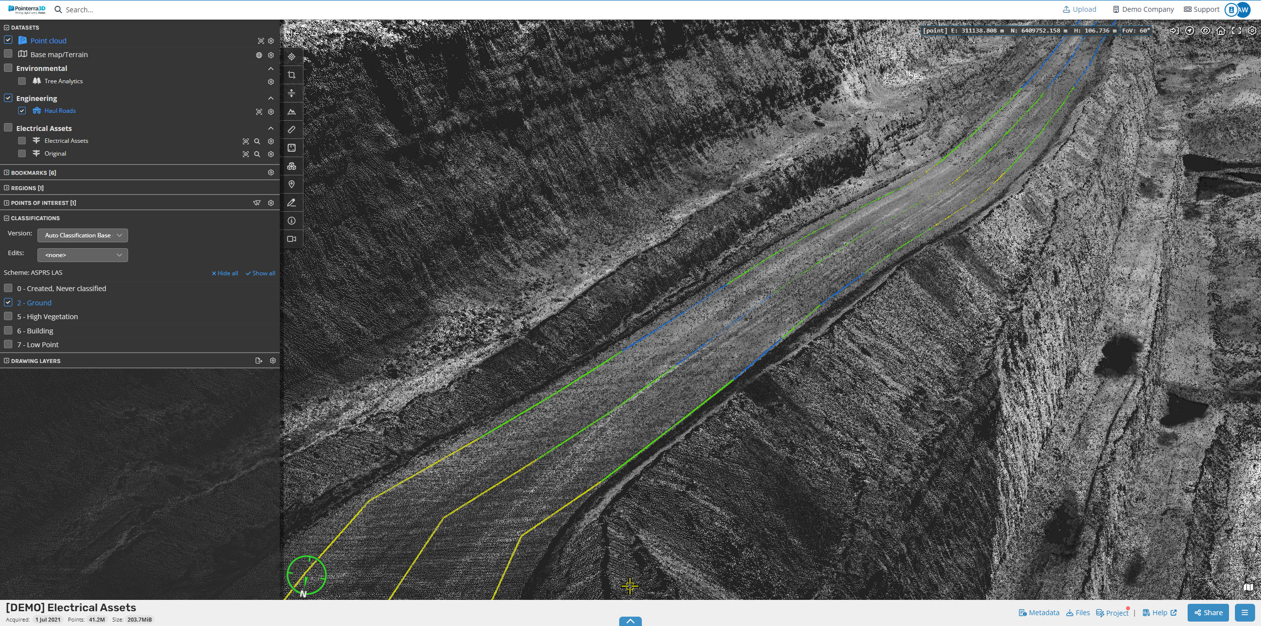
Road Widths - categorized based on width compared to a specified minimum requirement
Road Crossfalls - estimates the cross-grade of the road and categorizes them based on severity
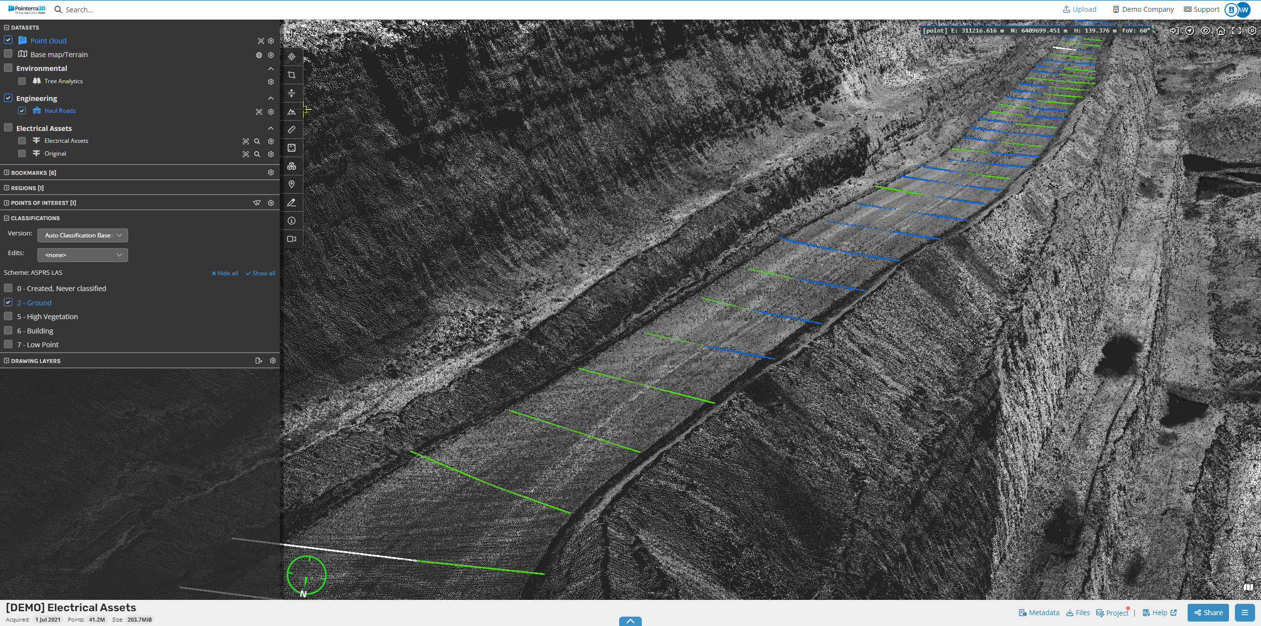
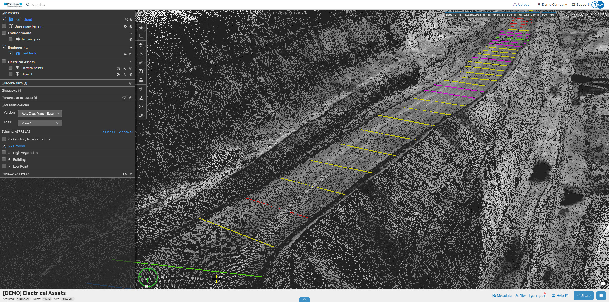
Road Berms - raised strip of ground that runs along side the road.
Windrows - natural guards used to contain the road and is categorized by the vertical height of the windrow
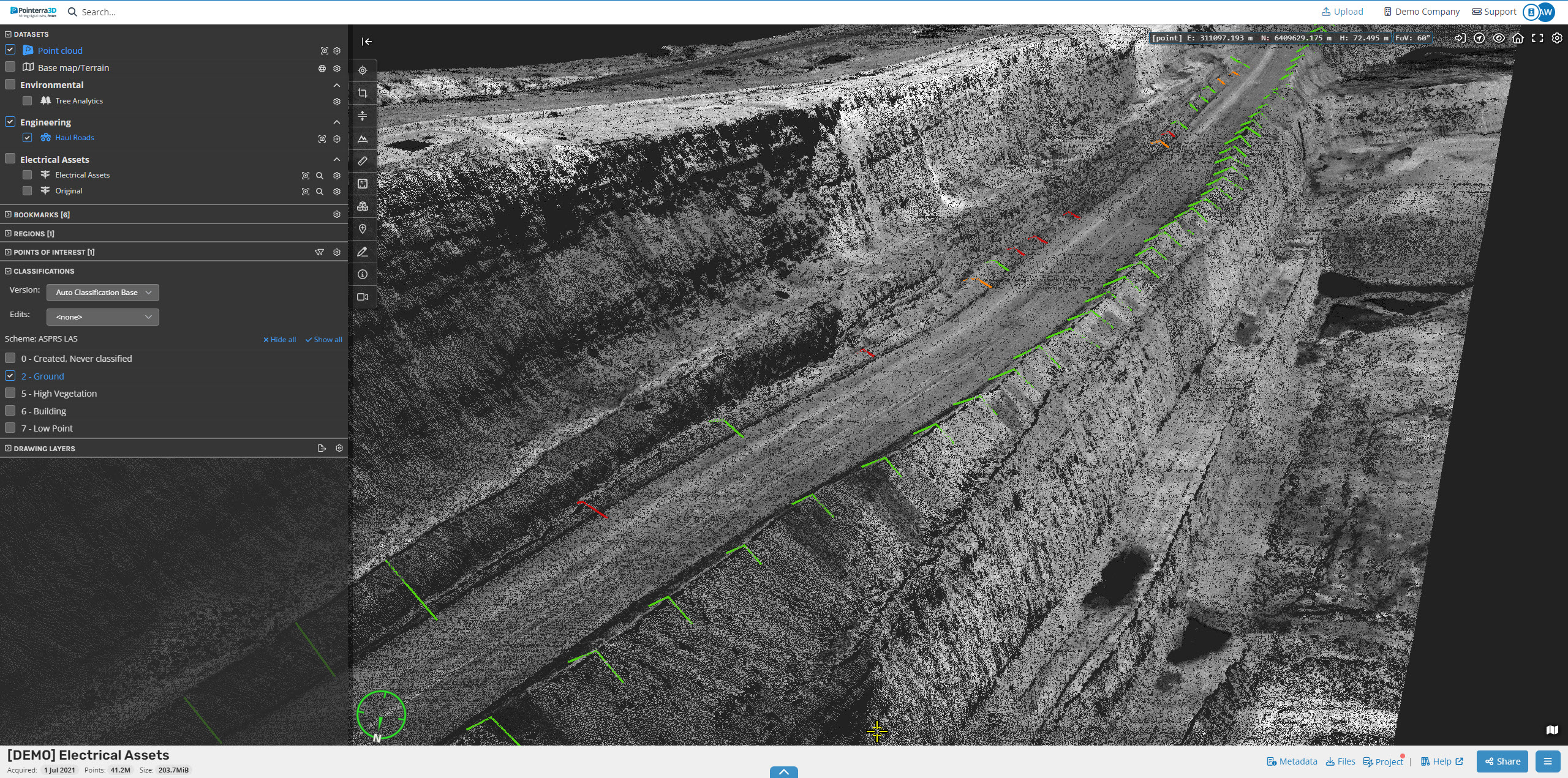
Intersection Angles - angle at which roads intersect and is categorized by the severity of the angle
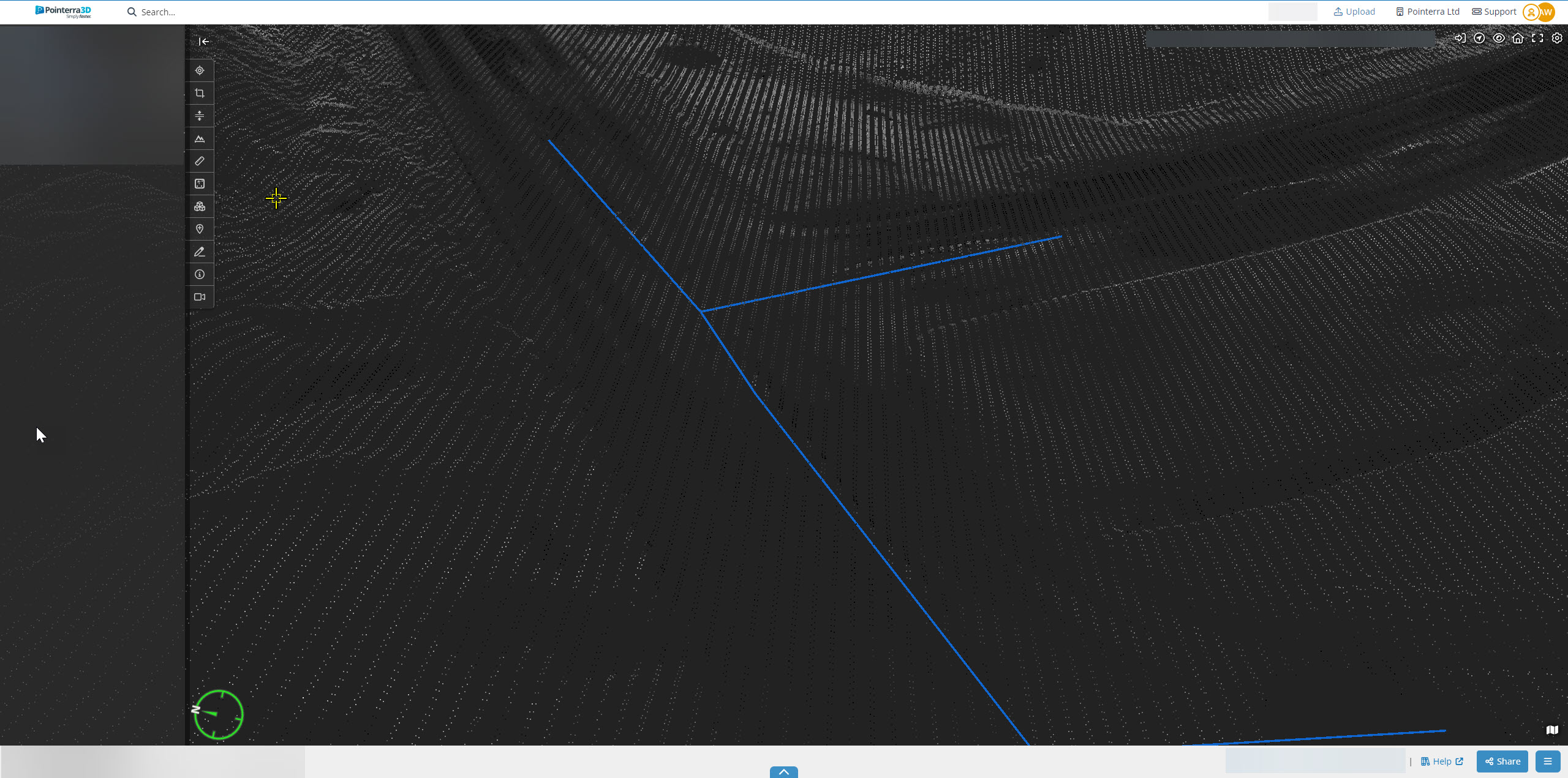
Intersection Distance - distance from one intersection to another (the circle in the middle of the intersection)
Process
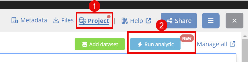
Select "Project" (1)
Click "Run analytic" (2)
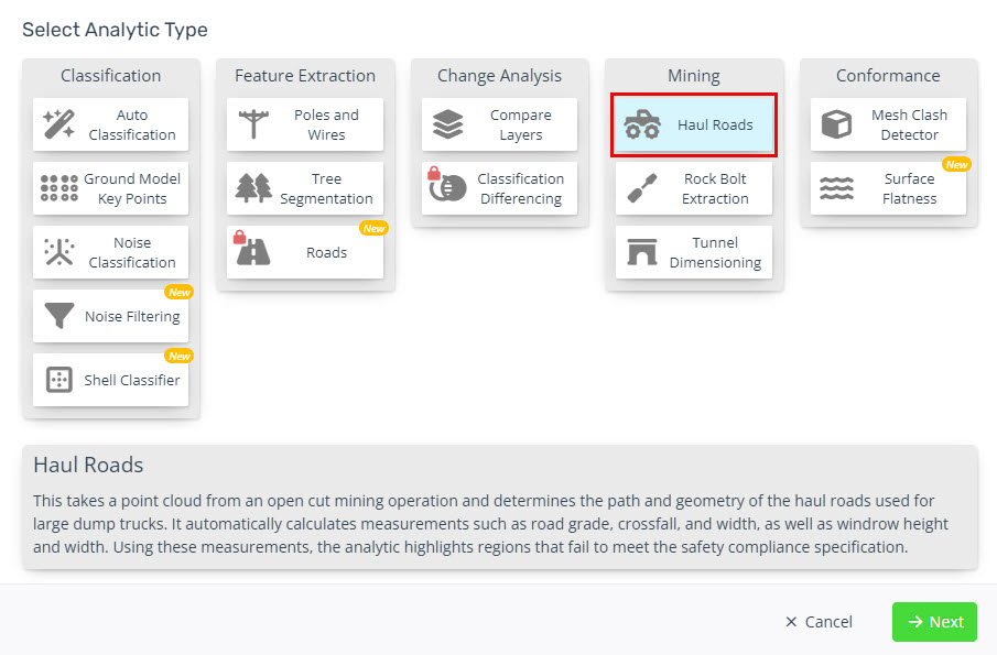
Select "Haul Roads"
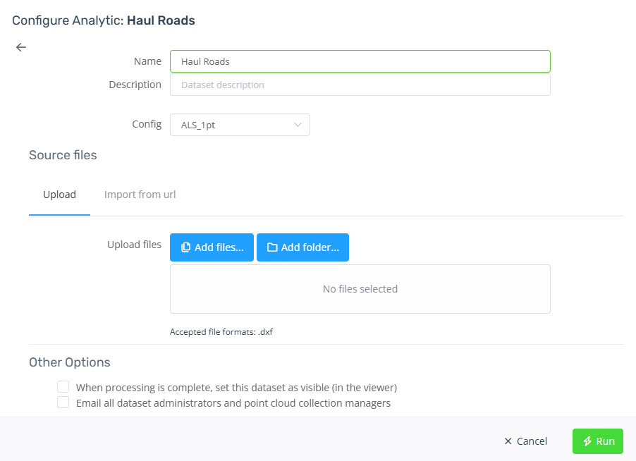
Enter a name and other descriptive properties if useful (Folder, Description, Date Acquired)
Select the configuration of the new data set
Add the centre line DXF file
Click "Run" to run the analytics
You will receive an email once the analytics completes.
The results will be view-able as a dataset in your point cloud project.