Release Notes - 15th March 2022
New Features
Resumable upload sessions
Point cloud uploads can now be aborted (either intentionally, or due to external issues, such as network dropouts) and resumed at a later time. Due to browser security requirements, you will still be required to reselect all the files that need to be uploaded, but the platform will automatically skip any files that were successfully uploaded before the previous session terminated - so only the remaining files will get uploaded upon resumption.
Note that for temporary interruptions, such as a network dropout, the existing retry logic has not changed and the upload should automatically recover if the connection is reestablished, without you needing to take any action. The new functionality is designed for cases where the upload cannot automatically continue - for example, if the browser tab was closed.
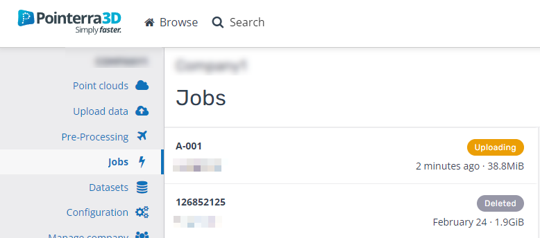
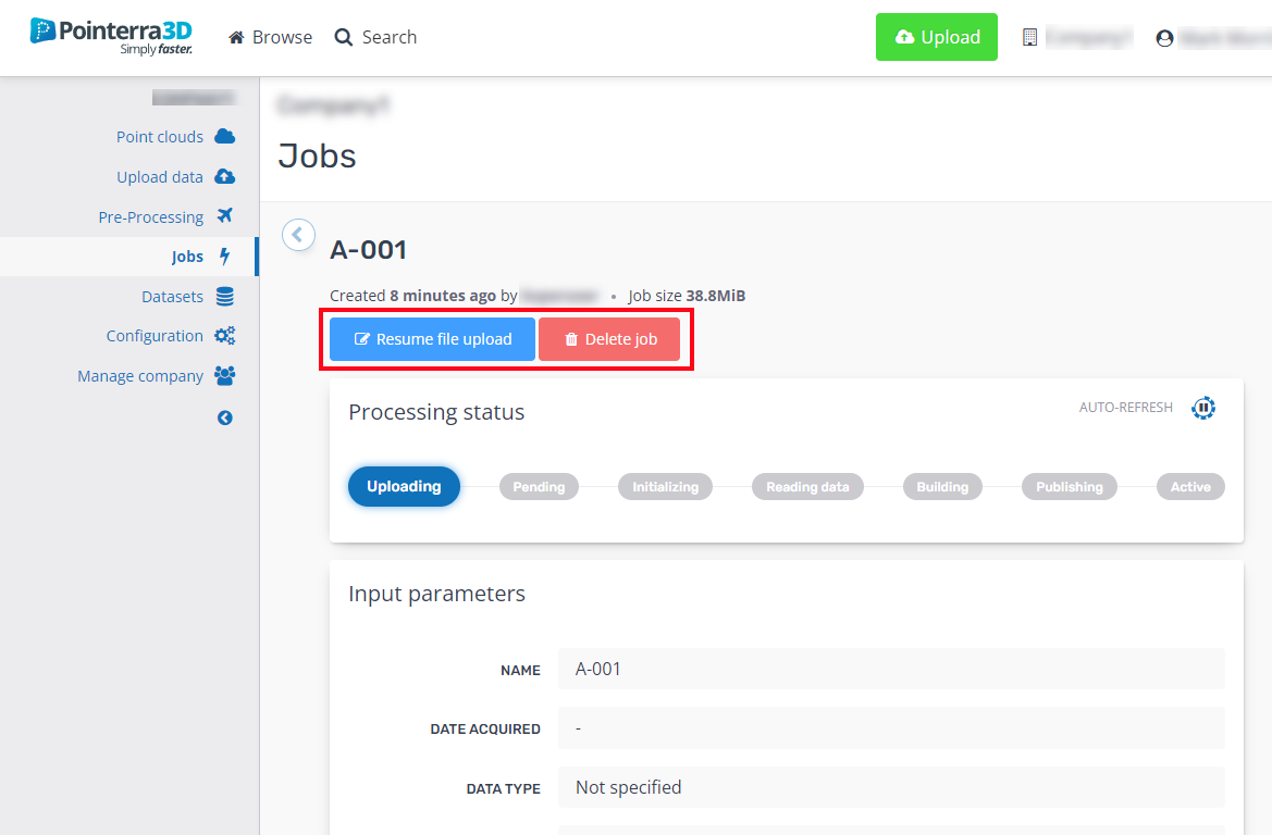
To facilitate this, there is now a new Uploading status for Jobs. All jobs will initially be in the uploading state until all files for the job have been successfully uploaded. A job that was interrupted during upload will show this status in the Jobs tab. From here, you can select Resume File Upload to continue (or Delete to remove the job).
 |  |
Overlay POIs, drawing layers and analytics digital twin models on spherical images and Scanview
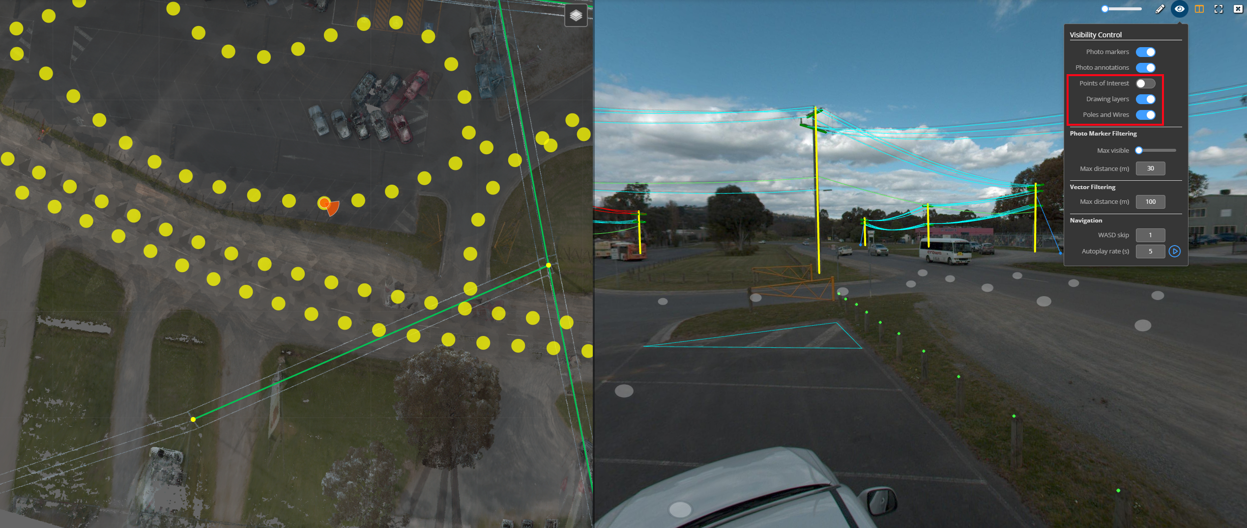
For spherical image viewing (both Scanview and 360 photo datasets), it is now possible to overlay Points of interest (POIs), drawing layers and other vector information (eg. Poles and Wires models from Pointerra analytics) on top of the spherical views. The ability to align the 3D features with the image pixels relies on having accurate image position and orientation - so this feature will only function correctly if these requirements are met for 360 photo datasets. In the case of Scanview, the alignment is inherently correct, as the views are generated directly from the point cloud.
The 3D overlays are not depth tested, so there is a max display distance property that controls how for away from the image center that graphic objects are shown.

Request source archive option to include files from datasets
There is now an option to include the files from a selected set of project datasets in addition to the point cloud file when requesting a source archive download. The zip file that is generated will also include a metadata file that contains metadata relating to each file in the archive.
Improvements/Changes
Pointerra Core
- The datasets folder view (in the dataset admin area) now uses a multi-page view so that the displayed folder list does not grow too long. This also improves the overall speed of the view.
- Vector importing now supports ESRI GDB format. Files should be uploaded as a zip file in the form YOUR_FILENAME.gdb.zip
- Loading of 360 photo multi-resolution image data is now better optimised and gives priority to the viewing direction.
- 360 photo split screen mode now has the option to have the 3d point cloud view in the left pane (instead of the map). Use the split screen menu button to toggle the display modes between, photo only, map + photo, and 3D + photo. The link icon will appear when the 3D view is active, allowing you to synchronise the 3D view with the 360 photo view. Note that the sync button will only be available when the 360 photos have valid orientation data.
- Hover the mouse over 360 photo markers to see the image name as a tooltip.
Analytics
- Wire catenary models now very accurately fit large spans by estimating and incorporating allowance for wire sway and other variations that may have been present during capture.
- Poles with large diameters are now automatically refined to provide an improved estimate of the pole center coordinate.
- Full clearance sample data (at 1m intervals) available for display in the viewer.
- Classification edits now auto-save after 3 minutes if there has been no user activity.
- When in multi-user classification editing mode (using regions), there is now an option to hide points outside of the region currently selected for a user.
Utility Explorer
- Full clearance sample data (at 1m intervals) available for display in the 3D viewer window.
- Wires in the 3D view are now correctly coloured by circuit type.
- You can now draw a box on the map (Use CTRL + drag mouse) to specify the active 3D viewing area when in Engineering mode.
- Points of Interest can now be moved after they have been created. Use the right-click context-menu over a POI and select move.
Bug Fixes
- LAS overrides were failing if the source point cloud data was uploaded in a ZIP file. The override now unzips the files before applying the updates.
- Point count estimates when using tiled exports could be significantly overestimated.
