Release Notes - 3rd February 2022
New Features
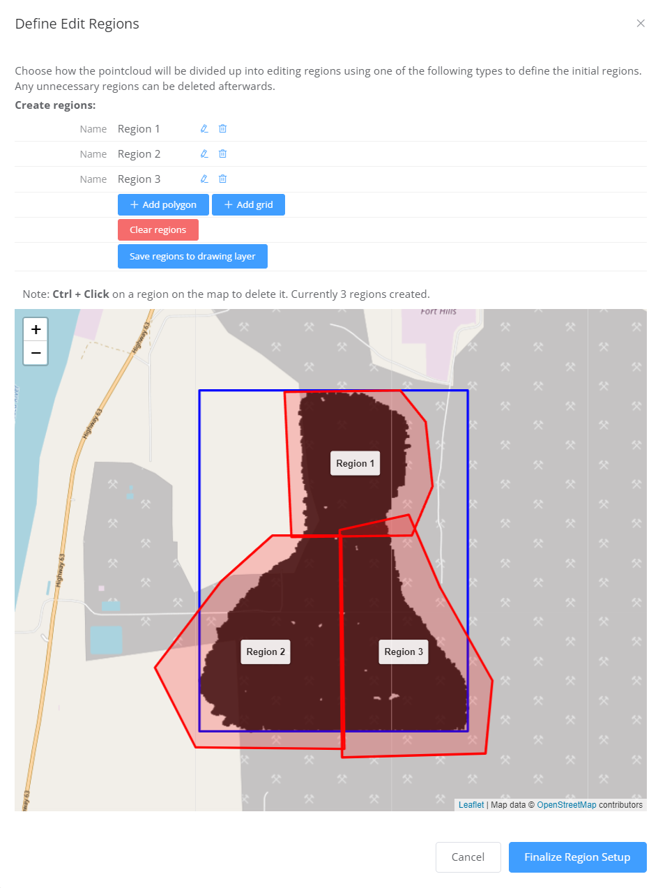
Multi-user management for classification editing
The classification editing tool now has support for dividing the point cloud into regions that can be assigned to users. Once all regions are complete, the results can be merged to create the final edit product. Analytics subscription customers should contact Pointerra Support to enable this feature on your account.

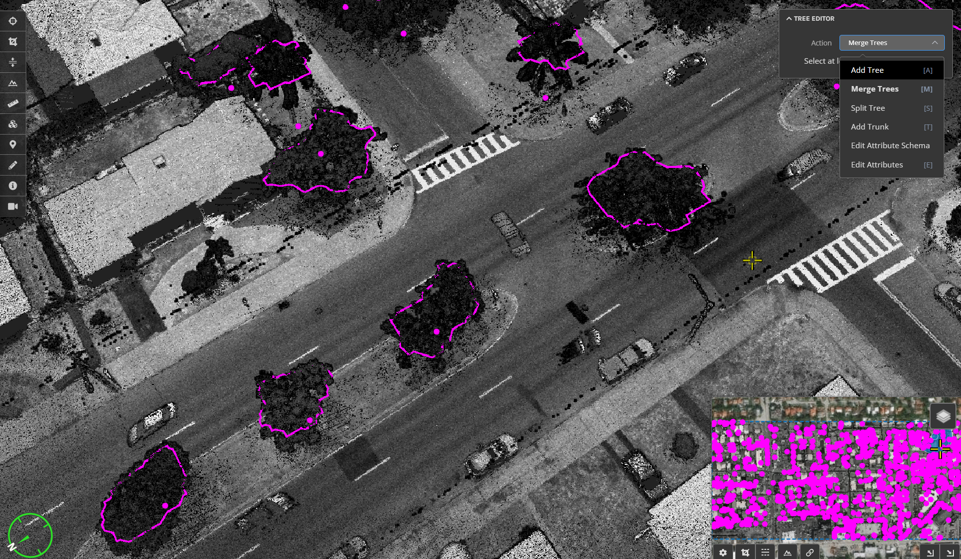
Tree analytics tools in beta testing
A new analytic to catalog tree and vegetation clusters is now in beta test mode. This includes a suite of editing tools to add, delete, split, merge, and attribute trees. For data that has sufficient density, tree trunk locations and diameters can also be estimated. Analytics subscription customers should contact Pointerra Support to beta test this feature.

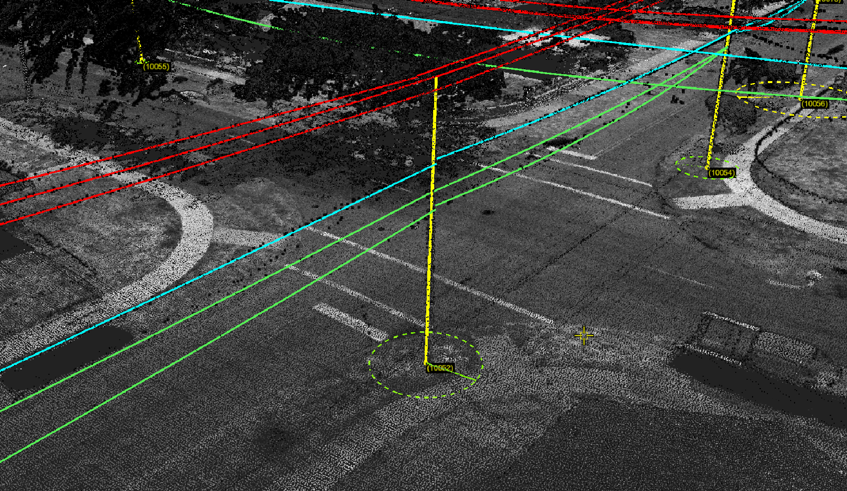
Pole lean information displayed in the 3D view
The calculated pole lean magnitude and direction information is now displayed as a graphical element in the 3D viewer. The radius and color of the circle indicates the magnitude of the lean, and a vector show the direction. Display of this information can be toggled by checking the Pole lean graphics checkbox in the Poles and Wires dataset options.

Improvements/Changes
Pointerra Core
- Display of base map imagery and terrain layers can now be independently controlled. This allows vector and orthoimagery layers to be draped on the terrain (clamped to ground) without also needing to show a global base map layer. Use the Load Terrain switch from the base map dataset properties to control the terrain loading.
- There is a new basemap layer option to control terrain depth testing against other data. Use the **Depth Test Terrain** switch from the base map dataset properties.
- Backface culling option added to 3D Model datasets to allow users to override the default behaviour.
- Importing TIF images with more than 3 bands no longer fails - the R,G, and B bands will be extracted for display.
- It is now possible to create a link to a saved bookmark to allow opening the viewer directly at a bookmark. Click on the "Link" icon on a bookmark to copy its link to the clipboard.
- Copy coordinate to clipboard menu option added to ScanView mode.
- Improved detection of mobile device browsers to customise the user experience.
Analytics
- All attribute names are now treated as case insensitive in Poles and Wires datasets.
- Wires with assigned circuit types can now be reverted back to the unassigned state.
- When a span or wire is deleted, any associated encroachment points are now automatically deleted.
Utility Explorer
- 360 degree panoramic image datasets are now supported (map layer and photo viewer).
- Photo locations can now be displayed as a map layer.
- Pole lean graphics is available as a map layer.
- Points of interest can be used to define key locations (e.g. road crossing locations) for reporting minimum wire clearances.
Bug Fixes
- Processing point clouds with a very large number of input files (e.g. more than 100K files) would sometimes fail with a timeout.
- Generated KML files could sometimes contain invalid characters from included attribute values.
