Release Notes - 6th May 2022
New Features
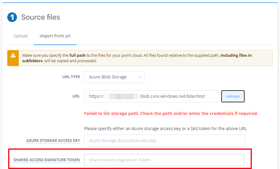
Azure SaS token support
The Import from Azure function now includes the ability to use a SaS token for authentication (as an alternative to an access key). When using a SaS token, you still need to supply the path (to a folder) and should ensure that the lifetime of the token is sufficiently long to allow for the upload to Pointerra to complete before the expiry.

Link to a Point of Interest
There is now a mechanism to create a link to a Point of Interest. This link can then be used to initialize the view to a POI. When saving a CSV/Excel spreadsheet from the POI layer properties, link URLs are now included as a new column. This will allow POIs to be saved or displayed external to Pointerra, with the ability to provide a way for the user to view the POI in Pointerra3D.
You can also copy individual links to the clipboard using the "link" icon for each POI in the POI list panel.

Improvements/Changes
Pointerra Core
- The marker color for 360 photo datasets can now be set when the dataset is created and in the layer properties in the viewer (for both the map and 3D views).
- Downloading a source archive did not give the option to include dataset files if the point cloud size was below 500M points. This has now been changed to always provide the option.
- Added support for importing un-georeferenced .tif, .jpg and .png files with accompanying .tfw, .jgw and .pgw world files, respectively. As these are un-georeferenced, you will need manually to specify the spatial reference.
- If you supply a spatial reference when importing a Geotiff, the SRS information in the Geotiff file will be ignore and your supplied information will be used.
- 360 photo viewer will not show the option to split screen with the 3D viewer when the photo orientation data is tagged as not accurate.
- Text selection enabled in the info tool value column to allow copy to clipboard.
- There have been further improvements to the error reporting when point cloud processing jobs fail. Users should received more specific and useful error message in the email.
- Better reporting of which files have errors if there are corrupt files discovered while processing.
- Significant improvements in reducing the processing time for 360 panorama photo sets.
Analytics
- Encroachments can now be regenerated interactively for a span in the final version. This allows classification editing to remove spurious points and then recompute the encroachments.
- Editing of final version poles and wires datasets is now disabled by default (all tools are hidden), except for encroachment edits. There is an option to re-enable the tools if required.
- Potential ground classification errors and misclassification at the edges of some point clouds has been rectified.
Utility Explorer
- A new button to open the Change Explorer has been added to the main navigation panel.
- Support has been added for linking to a Cyclomedia account to display 360 imagery coverage and panoramas from Cyclomedia
Bug Fixes
- Linestrings from GDB were only importing the 2 endpoints. All vertices are now imported correctly.
- Displayed encroachment points in the viewer could appear shifted in rare cases
- Editing classifications could incorrectly change the class of all points if the roof tool failed to find points
- Polygon tool could sometimes drop out of edit mode and leave "dangling polygons"
- Polygon editing would occasionally get out of sync when moving the vertices of the polygon
- Reprocessing jobs sometimes ignored deleted files if the job had already been reprocessed in the past. The reprocessing file add/remove should be more robust now.
- Classification editing mode would sometimes fail to render points when some point classes were hidden.
- When editing classifications, points that had been edited were not being correctly used to compute occlusions if the point type was hidden.
- When using the point cloud crop tools in the viewer, there could still be some points rendering outside of the crop area. This has been rectified.
