Release Notes - 3rd August 2022
New Features
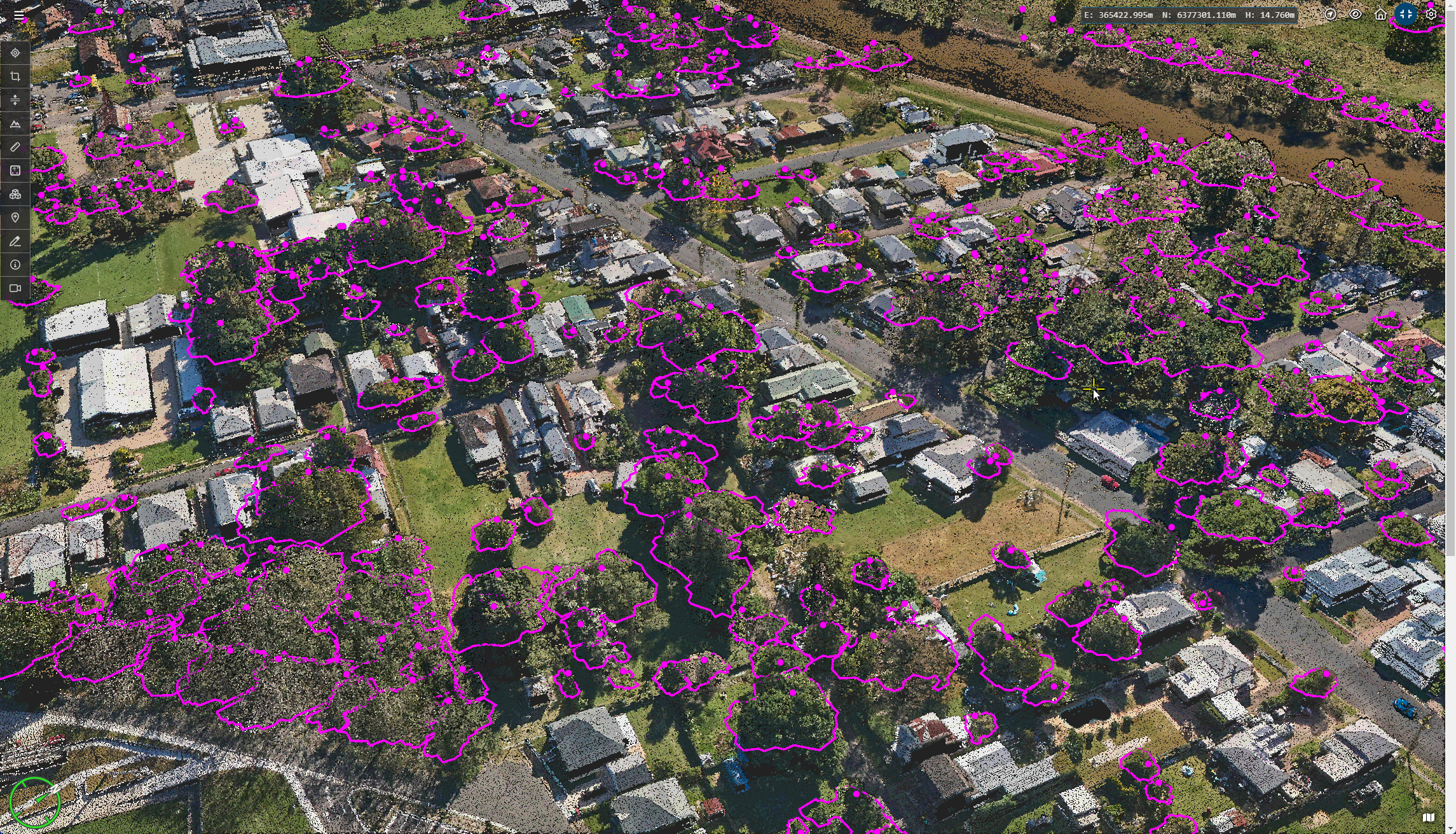
Dynamic tree analytics viewing and multi-user editing
Viewing of tree analytics data has been completely reworked to use a dynamic loading strategy based on tiling the tree data. Trees are now dynamically loaded (and unloaded) based on viewing direction. This allows the viewing of tree analytics results to scale to an essentially unlimited number of trees.

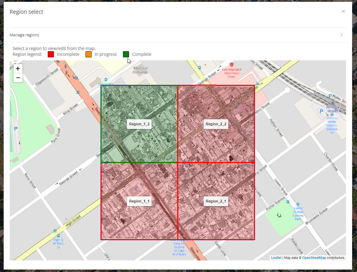
The tree edit tools, which allow operations such as: adding, deleting, splitting and merging of tree locations and crown polygons has now been made multi-user capable. This means that many users can edit tree data simultaneously and the results can be merged into a final layer once complete. This uses the same approach as the Poles and Wires multi-user editing, where the dataset can be split into tiles or polygon regions and assigned to users to work on separately. Conflicting edits are resolved at merge time.

Improvements/Changes
Pointerra Core
- Icons refreshed and add in many places in the viewer
- Dataset layers now have individual icons to distinguish different layer types
- Context menus now have icons
- Many other icon enhancements
- Portal user interface has been updated
- User profile menu now restyled with user initials.
- Browse/Home buttons removed and single Home view reworked
- General tidy up of layout and styles
- Improved responsive layout for mobile devices
- Improved detection and handling of 3D "space mouse" devices
- Improved handling of XBox controller devices
- New user permission added to allow editing of analytics datasets without giving full edit permissions
- Created ZIP archives of source files no longer use compression. This results in significantly reduced time to generate the output.
- Image datasets now allow .tiff as a known/supported extension (.tif was already supported)
- Improved support for Azure and HTTPS file ingestion - mainly for API users
- ScanView now supports split-screen viewing with the 3D point cloud (hover over the splitscreen menu button to get this option)
- Drawing layers now save each layer separately and detect if another user has saved a newer version. This is reported as a warning before you save to avoid overwriting changes.
- Improved handling of projects with a very large number of scan setups. Sometimes the map markers would render slowly in this case.
- Improved the accuracy of ray casting into the point cloud to get the best 3D coordinate for a pixel in a 360 photo
Analytics
- Haul roads analytics now supports using multiple ortho images in the created PDF reports
- Orthoimages used in Haul roads analytics no longer have to be called "ortho"
- Improved tree clustering algorithm
- for higher density LiDAR where tree branches and trucks can be found and followed.
- Improved detection and modelling of dual-wire transmission catenaries.
- Improved low vegetation getting mis-classified as noise.
Utility Explorer
- Large PDF reports could take a long time and in some cases cause a crash. This has been resolved.
Bug Fixes
- Very small mouse or camera movements would sometimes not trigger new points to be loaded.
- Translations to datasets containing multiple 3D models would on get applied to the first model.
- Fixed a bug where classification editing could incorrectly recode all points of a class in some rare cases.
- Polygon classification tool could hang while saving changes for some point clouds.
- Uploading 360 images would fail when uploading with a non-georeferenced point cloud.
- Archived point clouds are no longer included in the recently viewed list.
