Release Notes - 6th March 2024
New Features
Master Model workflow
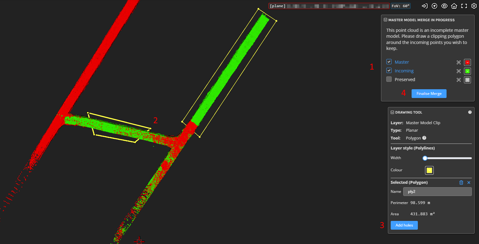
Pointerra's Master Model workflow is a way to manage constantly changing/updating point cloud data. It allows you to selectively (using a set of polygon regions) merge new data into an existing point cloud (your master model). The result of the selective merge is that you only keep the most up-to-date points and mask out any old or obsolete data that you want to replace. The process of working with master models effectively creates a timeline of snapshots of the environment without having to rescan the entire project area. The current implementation is suitable for projects where a 2D (top-down) polygon mask is suitable for defining regions.
The Master Model feature is currently in beta testing. Please get in touch with our support or sales team to test with your own data. Additional help docs can be viewed on the help site.

New Analytics and Dataset UI
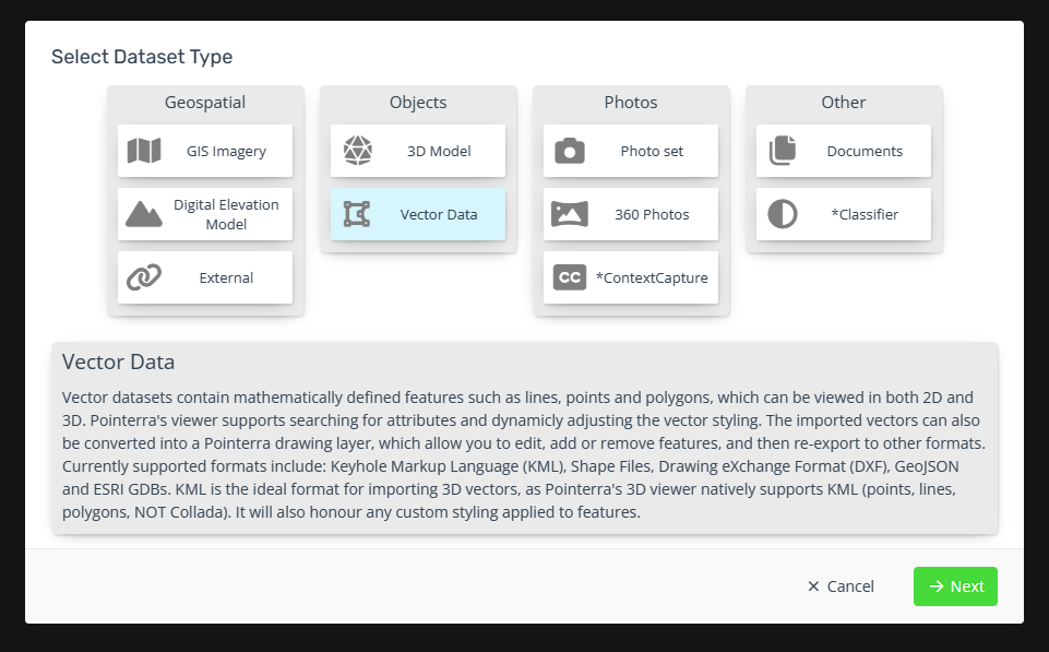
Refreshed the UI and workflows for creation of datasets. There is now additional information presented around the purpose and supported data/filetype for each dataset.


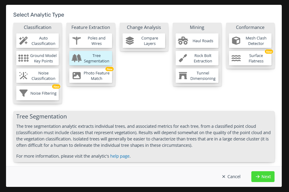
Separated analytics from other dataset types and made unavailable analytics discoverable.
Improvements/Changes
Pointerra3D Core
- Made a number of improvements to the way that ScanView images load and transition, resulting in faster load times and smoother transitions between scan setups. Note that some of the changes will only affect new point clouds.
- Added a tool panel to show additional information when adjusting the transform of a 3d model.
- Updated wording on share link password entry page to make it more obvious that the user needs to enter the provided share link password (not set up an account to get a password).
- Changed the move dataset folder chooser to scroll with large numbers of folders and highlight the selected folder more obviously.
- Time overlap between the trajectory and RXP files is now automatically handled for pre-processing jobs.
- Added scrolling for larger point cloud warning messages.
- Improve display of multi-line user messages. Also auto-adjust font size for long messages.
- User messages are now also shown in the metadata tab (as a section called Additional Information).
- Added an option to lock the camera at a POI location (use context menu).
- Improved mouse controller interaction when no picked point is found.
- Improved the layout of the info tool panel for long text values.
Analytics
- Version 3 Poles & Wires report generation now include network KML & GeoJSON outputs.
- Ignore invalid CSV rows when importing into a Poles & Wires dataset.
- Only report spans as "Not matched" when running the assign wire attributes tool if they have a wire that matches the circuit filter.
- Add bulk attribute editing capabilities to v3 tools - similar to v2 P&W
- Tree analytics now includes an option to generate a rasterized geotiff of the canopy footprints.
- Standardize P&W report date format so that it is clear irrespective of region.
Utility Explorer
- Allow publishing of a P&W dataset in a project that already has a dataset linked to UE. The new dataset can be published to UE as new version of the existing dataset, or as a completely new dataset with a user-provided custom name.
- Improved "Survey Finding" user experience/workflow.
- Squashed numerous minor bugs with image inspection workflow/UI and the image viewer.
Bug Fixes
- Fixed coordinate system chooser not populating the search results in the point export form.
- Ensure POI coordinates exported to CSV have enough precision when spatial reference is geographic (lat/lon).
