How can I inspect the source photos for a Point Cloud I generated using Pix4D
If your Point Cloud was generated using Photogrammetry the Pointerra platform can support photo inspection. This will allow you to click any point and then view the original photo(s) of that location. The following guide explains how to do this for data processed with Pix4D.
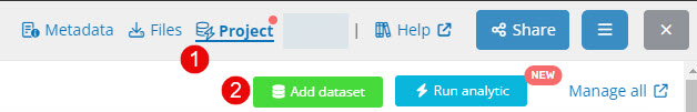
- Upload the point cloud (laz). Once import complete navigate to its Project (1), as shown below.
- Click Add dataset (2)
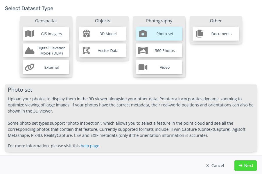
- Select Photo set
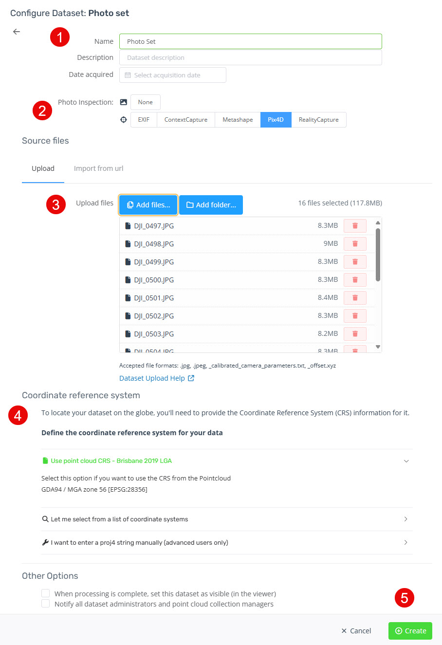
- Fill in the Dataset properties
(1) Give the Dataset a name
(2) Set the Photo Inspection mode to Pix4D
(3) Add the photos and the following outputs from the Pix4D project
*_calibrated_camera_parameters.txt
*_offset.xyz
(4) The Pix4D metadata should be in the same coordinate system as the point cloud, so select the Use Pointcloud SRS option.
(5) Click Create button to start the upload.
- Once the upload and import completes you will receive an email. Refresh the Point Cloud web page to use the Photo Inspection dataset.