Calibrate: Job Review
Monitoring Processing status (Raw Individual Mission Jobs)
At completion of upload processing will automatically trigger and undertake:
- Pending/Initializing - Uploads data and retrieves the 'Sensor Configuration' parameters.
- GPS Proc. - GPS Processing of raw Trimble/Applanix airborne GPS files to generate a post-processed trajectory in the designated horizontal datum. If base station data is uploaded with the airborne GPS a 'Single base' solution will be undertaken. If no base station data is uploaded the Trimble PP-RTX service will be incorporated. Sensor Configuration antenna records and lever arm parameters are incorporated into the processing.
- LAS Conv. - Convert raw Riegl RXP or SDF files to LAZ 1.4 point format 6 utilizing the post-processed trajectory and the Sensor Configuration calibration parameters.
- Strip Align - runs a rigorous alignment (boresite, X, Y, Z and High Frequency Drift) between all overlapping strips within the mission and export an updated set of LAZ files.
- QC Reports- generates QC maps for visual review prior to building a point cloud.
- QC Pending - finalizes all QC reports and populate them into the Job Review page for a user to complete QC prior to finalizing the job.
- Complete - updates when the user selects either of "Mark as Complete" buttons at the bottom of the Job Review page.

Input Parameters
Records all inputs from the Upload page for QC.
- Name of the sensor dataset.
- Sensor config used.
- Date Acquired.
- Coordinate Reference System.
- Horizontal Datum.
- Vertical Datum.
- Vertical Unit Scale.

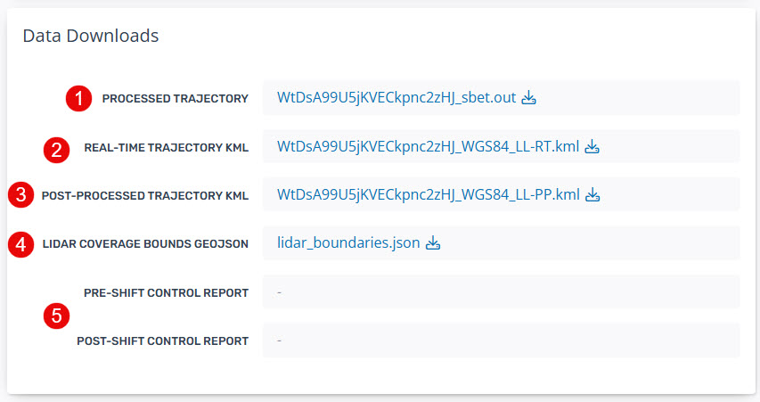
Data Downloads
- Processed trajectory file in Applanix smoothed best estimate trajectory (SBET) file.
- Real-time processed KML is available for users to evaluate in differences between the raw and processed trajectory extents.
- Post-processed KML is available for users to evaluate in differences between the raw and processed trajectory extents.
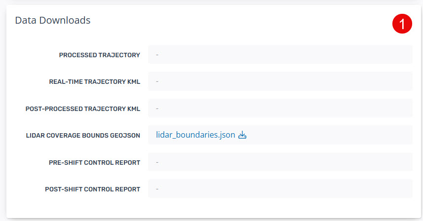
- The LiDAR coverage boundary as a Geojson file.
- Pre-Shift and Post-Shift Control Reports will be available when using their respective custom processing.
Processing Logs
- GPS Processing - "Open Review Page" to review any intermediate gps processing logs (e.g. Extract log). This will load as a new browser page.
- Wavex Logs - select the link to load a new browser page containing the full processing log from the "LAS Conv." stage.
- Stripalign Logs - select the link to load a new browser page containing the full processing log from the "Strip Align" stage.

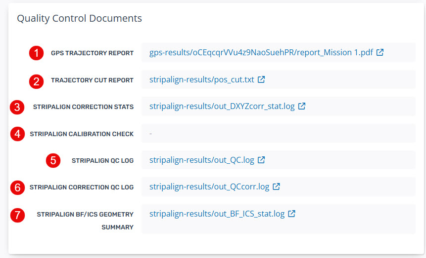
Quality Control Documents
The two main processing stages requiring 'Quality Control' produce a QC document available for viewing at the completion of processing.
- GPS Trajectory Report (PDF) - the full POSPac Diagnostic QC Report containing records of all inputs, lever-arm parameters, processing methods and accuracy plots.
- Trajector Cut Report - available with UAV processing.
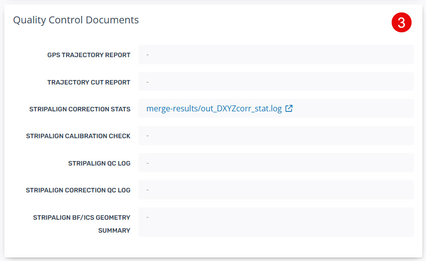
- Stripalign Correction Stats - the DXYZ correction statistics for all LAZ strips. This reports the Mean, Standard Deviation, RMS and Min/Max shifts between strips as well as the overall average.
- Stripalign Calibration Check - Outputs when Block survey type is selected. This provides a report on recommendations to update the calibration parameters in sensor configuration.
- Stripalaign QC - Provides a summary QC report on the calibration.
- Stripalign QC Correction - Provides a detailed summary of the correction statistics.
- Stripalign BF/ICS Geometry Summary - Provides the geometry summary for each swath.
Quality Control Map
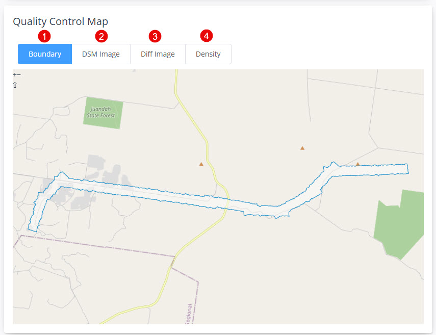
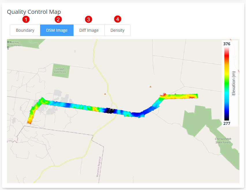
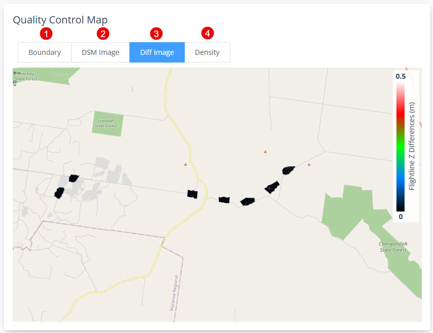
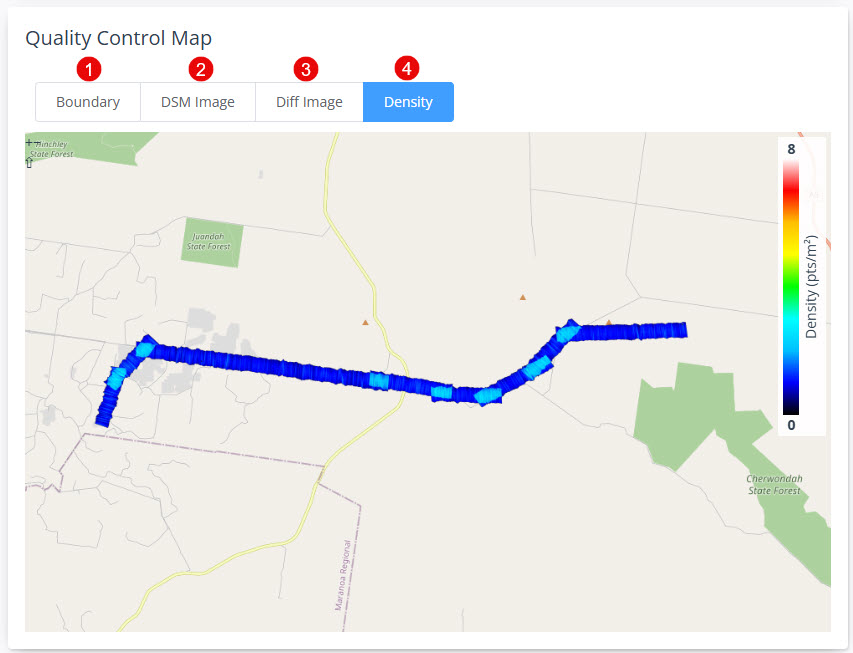
The Quality Control maps provide the user with the ability to visually review the Pre-Processing data outputs prior to building the point cloud in the Pointerra format. The four views are available under the 'Quality Control Map' header and are overlaid on a 2D map. The views are:
- Boundary - of the LiDAR point cloud for project coverage checking.
- DSM Image - generalized surface of the LiDAR point cloud useful for detecting high levels of erroneous noise points or data gaps.
- Diff Image - provides a visual indication of the strip alignment results from Stage 4.
- Density Image - provides a visual indication of the point density.
Ready to go?
Follow the instructions to update the job status to complete using either the 'Mark QC Complete' or 'Mark QC Complete and build point cloud' depending on the next stage of your workflow. Both buttons contain tooltips to advise the user on selecting each option. Each button will:
- Mark QC Complete: this will update the Processing Status to Complete.
- Mark QC Complete and Generate Point Cloud: this will update the Processing Status to Complete and start a new job to build a point cloud for viewing in the Pointerra application.

Details
Records all inputs, processing parameters and processing result records for the Job. These records can be used to debug any unexpected results from processing.
Monitoring Processing status (Merged Mission Jobs)
- Once a merged job has been triggered you will be redirected to the Job Review page where you can monitor the status of processing through to the QC Pending status.
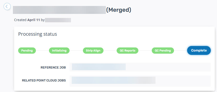
- Once processing is completed the user can:
- Select available files for Data Downloads (1)
- Review the Stripalign processing log (2)
- Review the Stripalign correction log (3)
- Review the Quality Control Maps (4)

- If it is determined that data has been successfully merged the "Mark QC Complete and Generate Point Cloud" button will run the point cloud builder job to allow the user to view the final point cloud in the Pointerra viewer.

Review Pre-Shift Control Point Reporting
- Once a Calculate Control Adjustment job has been triggered you will be redirected to the Job Review page where you can monitor the status of processing.
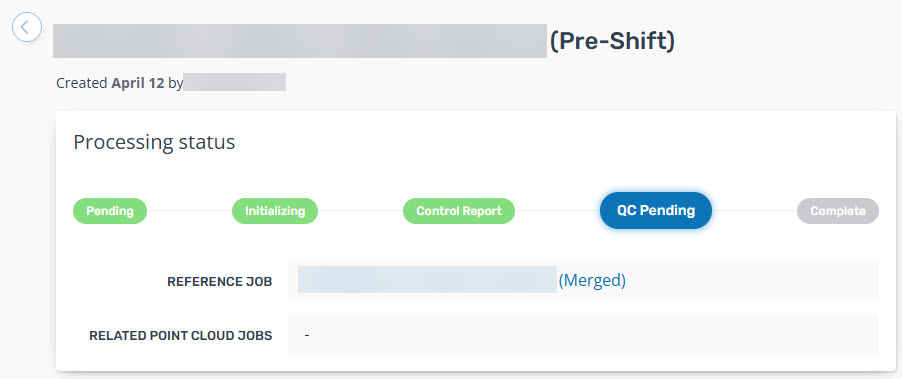
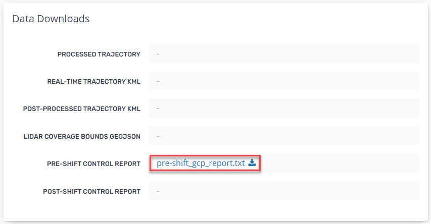
- Once the status reaches the QC Pending stage scroll down to the Data Downloads section to download and review the pre-shift_gcp_report.txt.
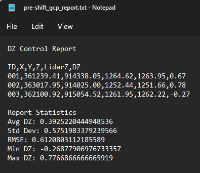
- The downloaded text file contains a Dz (elevation difference) comparison to each ground control point and at the bottom the combined statistics of:
- Average Dz (of all GCPs)
- Standard Devation (of all GCPs)
- RMSe (of all GCPs)
- Minimum Dz (of all GCPs)
- Maximum Dz (of all GCPs).
- All values are in the native units of the point cloud.
- From this report users can choose to:
- Utilize the Average Dz value in the Apply Ground Control Adjustment stage.
- Remove and outliers and re-run this stage or re-calculate the Report Statistics external to Pointera3D.
- Mark QC Complete for this job as there is no new point cloud data created in this job.

Review Post-Shift Control Point Adjustment
- Once a Control Point Adjustment job has been triggered you will be redirected to the Job Review page where you can monitor the status of processing.
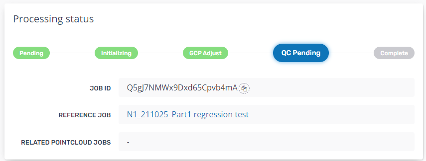
- Once the status reaches the QC Pending stage scroll down to the Data Downloads section to download and review the post-shift_gcp_report.txt.
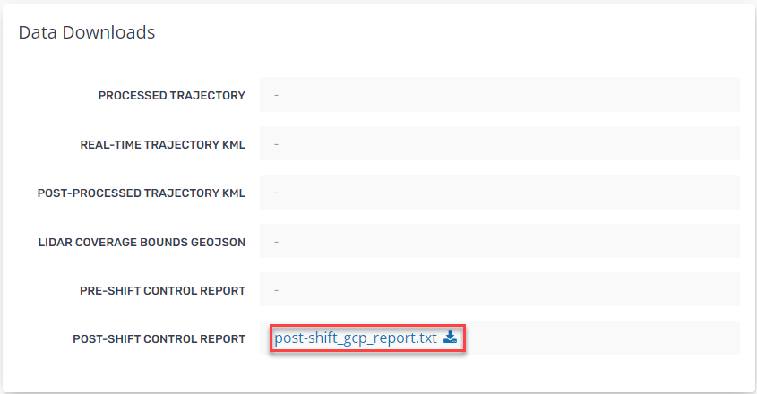
- The downloaded text file contains a Dz (elevation difference) comparison to each ground control point and at the bottom the combined statistics of:
- Average Dz (of all GCPs)
- Standard Devation (of all GCPs)
- RMSe (of all GCPs)
- Minimum Dz (of all GCPs)
- Maximum Dz (of all GCPs).
- All values are in the native units of the point cloud.
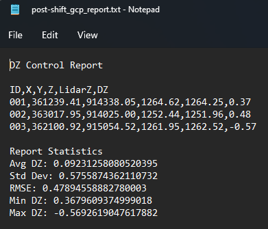
- From this report users can choose to Mark QC Complete and Generate Point Cloud to build this GCP adjusted point cloud to Pointerra3D for viewing.

