Release Notes - 30th June 2023
New Features
New Login Flow
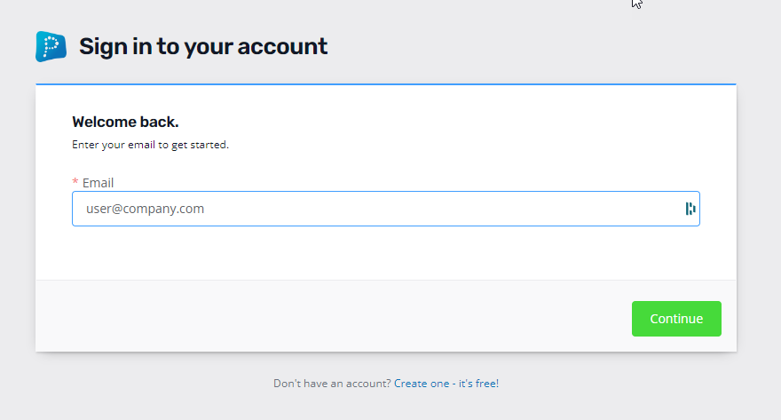
The login workflow for Pointerra has been reworked. You will now be asked to enter your login email address and the login interface will automatically transition to requesting a password or to using single-sign-on if configured (this will then request authentication using your configured provider). For SSO users, if you are already authenticated by your provider, then the login to Pointerra will be automatic - you will not be required to login at all (unless you explicitly logout of your Pointerra session)

Linked Apps
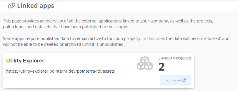
We've added a new section to the company page, called Linked Apps. This keeps track of any Pointerra-aware apps that are associated with your company, as well as any data that has been published to them. Linked Apps are other applications that have authenticated access to data in your account to provide additional services.

Linked Apps will typically be used to provide more tailored interfaces for particular tasks or industries. The Utility Explorer application is the first example of an application that uses the Linked App framework. Linked Apps will have benefits such as:
- Unified login across applications (you just login with your Pointerra account and have all the same permissions)
- Manage data in Pointerra core and control publishing to other apps.
- Specialised user interfaces to support specific workflows and industry needs.
- Ability for 3rd party developers to build add-on applications that have access to data in your account based on Pointerra logins and permissions (oAuth support)
Improvements/Changes
Pointerra3D Core
- Company reports have a new report that contains all point clouds in a KML file. The KML file has a boundary polygon for each point cloud, some basic metadata fields as attributes, and a link to view the point cloud on Pointerra as an attribute.
- Transferring ownership of projects could fail if there were datasets that were shared with an archived or deleted point cloud in the original owner's company. This no longer prevents the transfer (note that datasets shared with an active point cloud will still prevent the transfer). Ownership of the datasets is now changed to the receiver's company.
- When using the Restrict Dataset Browsing option (in Company options), users will now be able to see any datasets they already have permission to access due to being attached to another point cloud that they have permission to view. This applies when using the Available Datasets panel within the datasets tab on the point cloud viewer page. Previously, this setting would be overly restrictive and hide all datasets from the user that were not already attached to the current point cloud.
- The drawing tool has a new polygon object tool/type. This is only available when using a drawing layer that has a plane constraint. Polygons can have internal holes.
- When creating a new drawing tool layer, there is now an option to add a drawing plane constraint to the layer. All objects created on a layer with a drawing plane are constrained to lie on the plane. This means that the mouse automatically snaps to the drawing plane rather than other objects, such as points or models.
- Removed height option when creating a buffer polygon on a fixed height drawing plane.
- Removed ability to create buffer polygons for polylines defined on (non-fixed height) drawing planes.
- Added support for using the info tool to pick 3D models - this will report which model has been clicked on.
- Option to toggle use of a DEM dataset as terrain now shows as a globe icon (green when active) on the layer in the list of datasets. A similar icon is displayed on the standard basemap/terrain layer.
- Merged point clouds now show a symbol to highlight that they are merged. Hovering over the merge symbol will show more details in a tooltip.
- Added the ability to sort layers of a merged point cloud by name and creation date.
- Added two new coloring options (when using color by layers) for the merged point cloud layers that update with the sort order.
- You can now add tags to point cloud layers, which can be used to filter the list of layers. Filtered out layers can either be hidden or colored for comparison.
- Added a warning that appears when sharing collections with an external team explaining that sub-collections will not be shared - only the actual collection itself (this behaviour may change in the future).
- Display of file bounding boxes on the map view has been optimised - it could previously take some time to generate the layer.
- If there is extra metadata content for a project, it now displays correctly on all property views.
- POI importing from a CSV file has been made more robust by sanitising fields to remove leading/trailing whitespace and dealing with quotes.
- The DEM contour export now generates DXF files with 3D line entities (was 2D plus elevation attribute).
- Improve attribute search performance in vector layers.
- Added support for uploading Metashape projects as photo inspection datasets. See this help article.
- Added support for uploading RealityCapture projects as photo inspection datasets.See this help article.
Analytics
- Next generation Poles and Wires analytics format to support visualisation of unlimited size (via tiling) datasets is now in beta testing.
Utility Explorer
- Linked Apps functionality is now deployed for general usage (was in beta testing). This allows publishing (and unpublishing) datasets from Pointerra Core into Utility Explorer from within the viewer.
Bug Fixes
- Photo set imports using projected coordinates were not correctly calculating heights when using orthometric height datums.
- Fixed an issue that caused the processing of photo sets uploaded with a calibration csv that didn't contain rotation data to fail.
- Fixed a bug preventing creation of a zip archive for a reprocessed point cloud.
- Fixed classification version lists being empty when merging point clouds.
- Terrain datasets now correctly apply saved state in bookmarks and as scene defaults.
- When changing out of color-by-layers mode, sometimes the point coloring would not update to the new mode for a while.
- Fixed a bug preventing the user from inserting a vertex into polylines defined in the classification editor.
