The overview Map Window
The Overview map is an orthographic, top-down view of the point cloud, allowing you to easily interact with the point cloud via the Map Tools. The overview map shows the current camera location, camera view/orientation and a crosshair cursor helping you to keep track of the cursor location within the 3D View.

Using the Overview Map
You can pan the overview map by dragging with the left mouse button. You can zoom in and out using the mouse scroll wheel. Dragging with the SHIFT key held down will let you define a zoom box to quickly zoom to an area of interest.
The map can be enlarged or made smaller using the Map Controls in the lower right of the overview map. When the map is enlarged to half window size of full window size. the map will show more information such as the latitude and longitude of the centre of the overview map (only for georeferenced point clouds). Tools such as Horizontal Cropping, Corrdior Clip and Creating Cross Sections are available from the Map toolbar and can be used to interact with the point cloud via the overview map (eg. Cropping a region from the overview map).
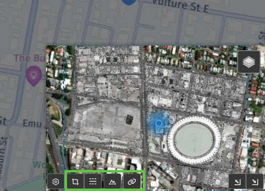
Using the Link Button next to the Map toolbar you can Synchronise the Map and 3D Views. You can also use the SPACE key as a shortcut to sync the 3D view to the current map extents.
Setting Map Display Properties
The "Cog" icon in the lower left of the overview map can be used to control which things are visible on the map such as whether to display the latitude and longitude of the map centre. Hovering over the "Stack" icon in the upper right of the overview map will reveal a menu where you can select which base map layer to display as well as control the visibility of other data layers such as Points of Interest and source files extents. You can also change which point cloud display mode (e.g. colour point by height) will be rendered as an overlay.

