Release Notes - 16th November 2021
New Features
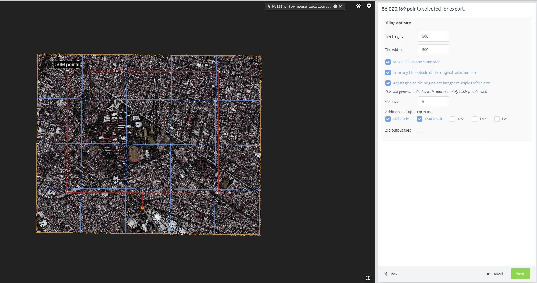
DEM/DSM export
Exporting the selected points to a DEM (for classified point clouds when ground-only is selected) or DSM is now enabled as a new export format option for all customers. The DEM/DSM generation includes an option to specify the cell and tile size and supports a number of output formats, including Geotiff and ESRI ASCII Grids. For more details, see the DEM export help article
Multi-user support for poles and wires edit tools
The Poles and Wires edit tools now support a workflow allowing an administrator to split a large project into multiple regions and have different editors working concurrently on assigned regions. Results are then merged back together to create the final edited product. Analytics customers should contact Pointerra support for more details, and to enable this feature in your account.
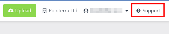
Integrated support request form
The portal now includes an integrated support request form. This can be used to log bugs, request help with using the platform, or to suggest a new feature. The support form can be accessed from the Support button in the top-right corner of the portal. See this help article for more details.
Dataset Administrators Team/Role
A new Dataset Administrators team/role has been added to the permissions model. User's that are added to this team have full permissions over the datasets within your account, but do not have access to the Manage Company tab to administrate users and billing functions.
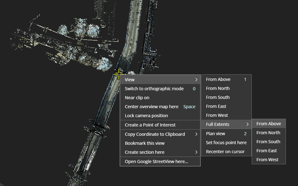
Preset viewing options
The context menu now includes a View submenu with a range of standard camera view setups (eg. view from above, view from north). A number of the existing view-related items, such as recenter view have been moved into the View menu.
Pole annotation tool
The Poles and Wires edit tools now include a pole annotations tool to allow a selected coordinate to be identified as a point of interest for a pole (it will be included in pole reports). This can be used to tag features on a pole that are not automatically identified by the analytics - for example, the planned location of a new attachment to a pole.
Pole refinement tool
For dense point cloud data, such as TLS or MLS, there is a new tool that allows a more accurate estimate of the pole vector to be determined. This will recenter the pole vector more precisely down the center of the pole by taking estimates of the pole shape and placing the vector through the center of the estimated (volumetric) shape of the pole. For MLS and TLS configs, the Add Pole tool will also automatically run the refinement process after the initial pole fit.
Goto my location search
A new search option has been added that will move the camera to your current location. The location is determined from the browser's location information. This is primarily designed for use in mobile viewing scenarios on a phone with GPS data.
Improvements
- The performance of the in-browser classification editing tools has been significantly improved.
- A new approach to classifying ground points has been implemented. This results in much better ground in sloping areas, and less low-veg/ground intermixing.
- Many of the Poles and Wires configs have been updated to new v3 analytics profile. This results in significantly less false-positive poles, more accurate wire modeling and improved building models. An auto-tuning approach has been added to reduce the number of different configs required to deal with sensor and density variations in the data. Overall results are far more accurate in the automated analytics than previous versions. Analytics customers should contact us to transition your existing configurations to to the new models.
- The Add (transmission) Tower tool is now more robust to sparse points and sloping terrain.
- Many improvements to the photo viewing tools. This includes improved zoom functionality and general performance improvements with load times.
- Share links now default the viewer units (eg. US feet) to the same units that were active when the link was created.
- When specifying a collection (eg. in the upload form), there is now a filter option to quickly find a collection by name
- Tiled exports are now supported for all customers. This allows large exports to be split across multiple (tiled) files.
Bug Fixes
- Some edit tools could cause a crash when used with very high density (ie TLS) point clouds.
- Clamp to ground functionality for photos would sometimes fail.
- Embed links were not loading some datasets due to a permissions error.
- Poles and wires edit tools would ignore clip bounds.
- 360 photo processing would fail if images were 8bit grayscale
- Sometimes there would be missing photos after processing a 360 photo dataset