The Viewer Interface
The viewer is used to interact with point clouds and associated datasets. The viewer interface contains 3 main parts: the 3D Viewer, the 2D Map View, and the Left Panel.
Interface Overview
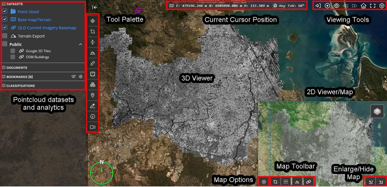
Within the 3D Viewer there are a number of tools that allow you to control the view, modify and export regions of the point cloud. These are accessible via the Tool Palette on the left side.
The Viewing Tools in the upper-right allow you to control the view and global settings for the 3D Viewer and 2D Map View.
Search for locations and Points of Interest
Control visibility settings
The Left Panel contains tabs that give you access to key elements of the current project, such as:
Any associated datasets
Scan display settings
Point cloud classifications
The Left Panel can be closed using the small arrow above the Tool Palette and opened again using the icon in the top left. The browser will automatically remember the state of the left panel for the next time you use the viewer.
There are also Keyboard Shortcuts that make it easier to navigate within the 3D Viewer.
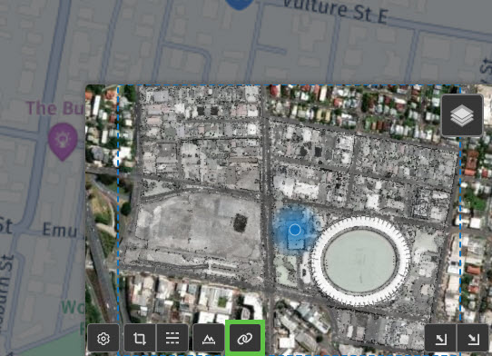
Overview Map
The Overview Map has its own visibility options and Toolbar as well as controls that allow you to change the layout of the 3D Viewer and the Overview Map windows. Note that increasing the size of the map view will display extra information such as the latitude and longitude of the map view centre. You can also use the Link Button (highlighted in yellow below) to Synchronise the map and 3D views.